ePrivacy and GPDR Cookie Consent management by TermsFeed Privacy Policy and Consent Generator PR TF 41 Playa del Socorro - Pico Teide (Route 0.4.0)

PR TF 41 Playa del Socorro - Pico Teide (Route 0.4.0)

PR-TF 41

Norte de Tenerife

Playa del Socorro - Pico Teide (Ruta 0.4.0)

Difficulty: Very high

Description

This trail, inaugurated in 2020 after major restoration work, is the highest in Spain, climbing almost 4 km in a single day. 

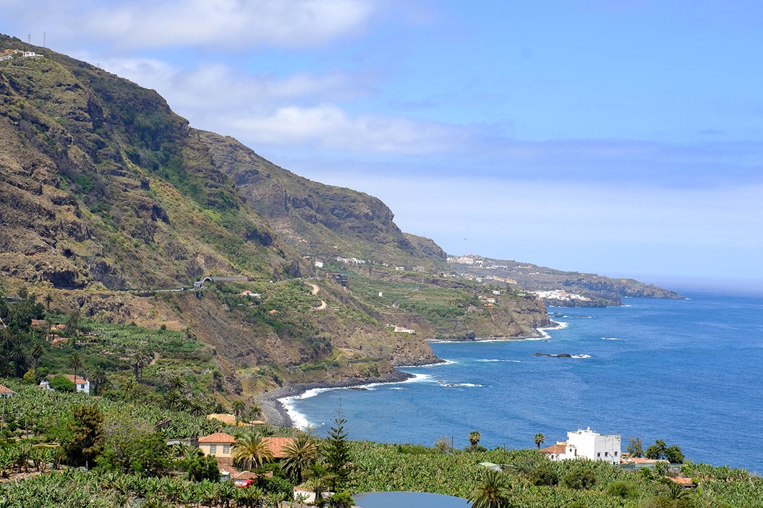
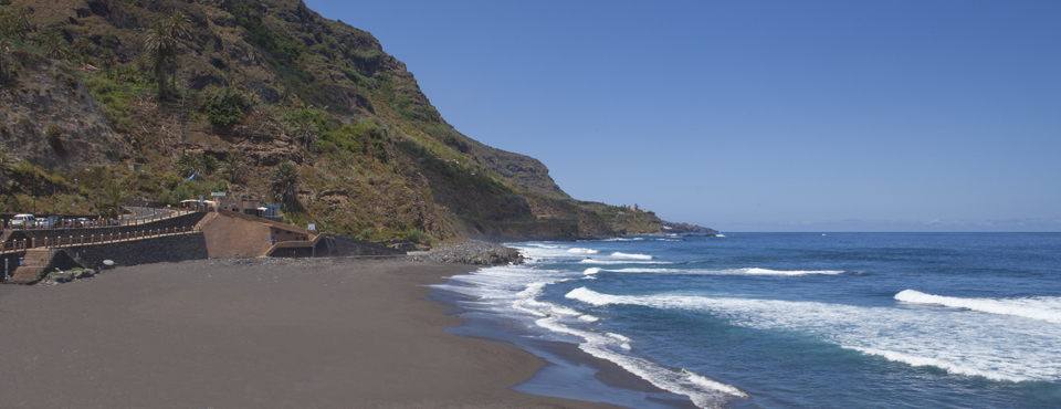
It starts at the Playa del Socorro beach in Los Realejos and climbs the Tigaiga mountainside to the Corona Forestal Natural Park. Along the way you can enjoy breathtaking views from the Corona and Asomadero viewpoints. 

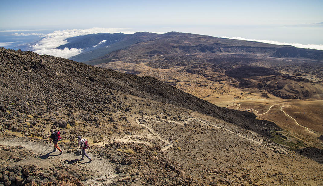
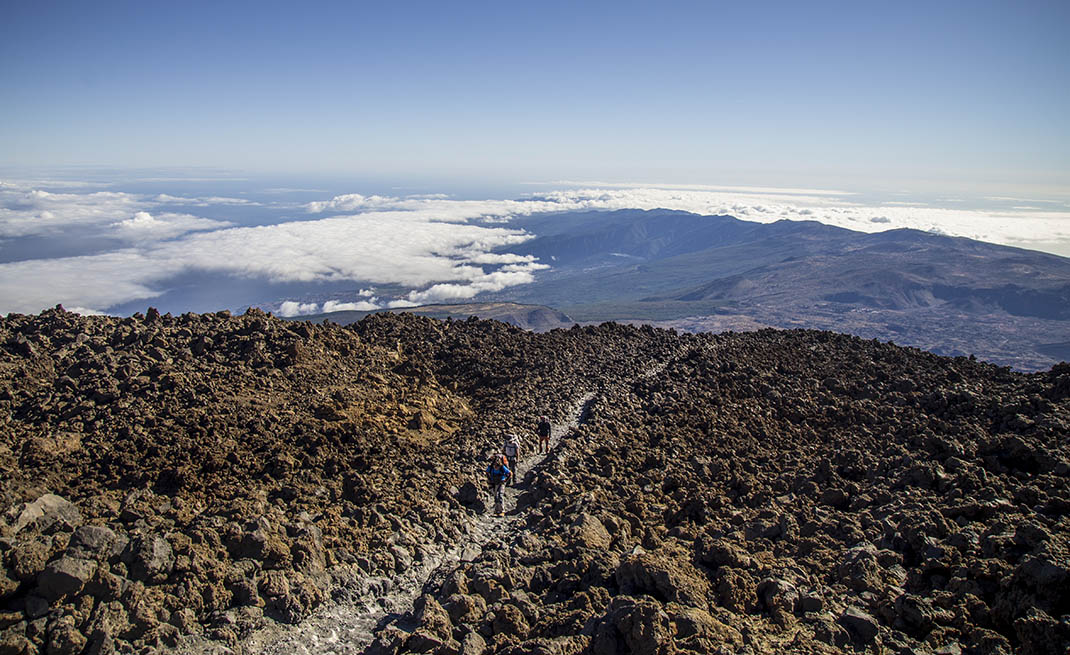
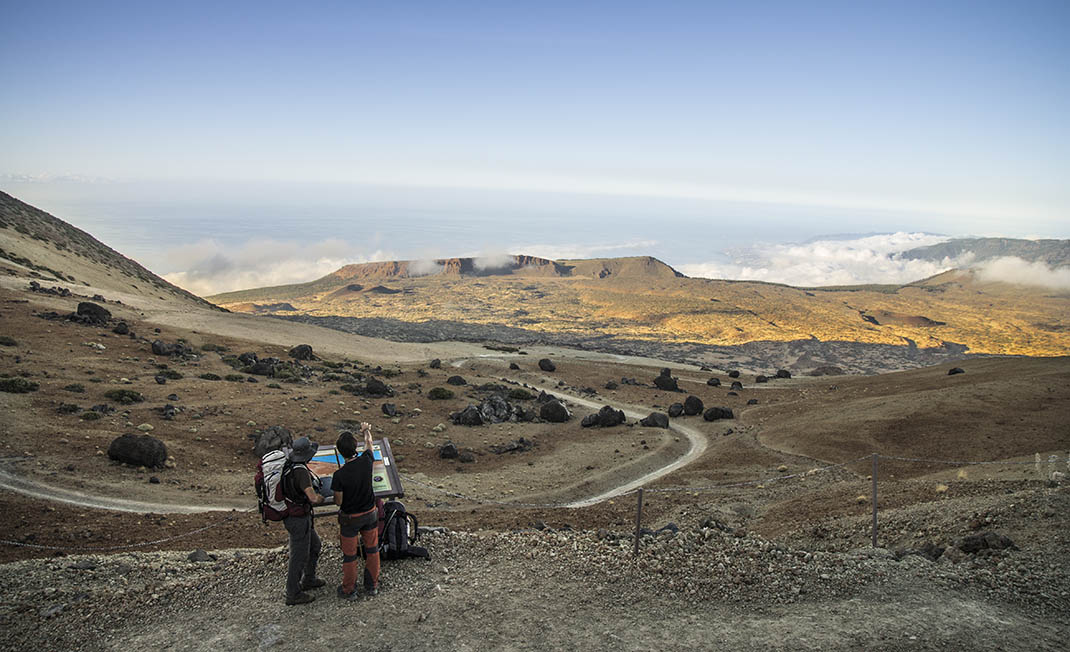
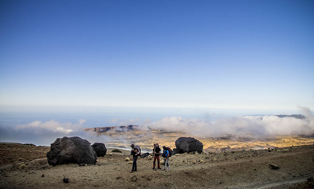
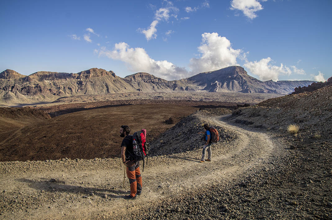
You will wend your way up through the Teide National Park, passing through a dense pine forest until you reach El Cabezón mountain, before reaching La Fortaleza, where you will begin a steep ascent to La Rambleta. 

Here you will reach the Teide Cable Car station and the end of the route, the highest point on the island that you can visit without a permit.

Tips

  • Always stay on the marked trail and do not enter private property, hunting grounds, water galleries, wells or caves.
  • Pay special attention when crossing or walking along trails used by bicycles, horses or motor vehicles and when walking in ravines with water courses.
  • Avoid direct encounters with potentially dangerous animals, such as livestock, beehives, and dogs. 
  • Proceed with caution and watch for obstacles, loose rocks, uneven terrain or steep slopes to avoid accidents and falls.
  • Check out our guide to hiking in Tenerife and, if necessary, contact the emergency services by calling 112.


Recommendations and tips

Guides

No data available

Permits

The last stretch of the ascent to the peak of Mount Teide from La Rambleta on the Telesforo Bravo trail requires prior authorisation for all visitors. 

For the rest of the route:

  • [TEMPORARY MEASURE] Free access without authorisation or reservation for natural or legal entities of a public or private nature, both non-profit (town councils, schools, associations, clubs, etc.) and for-profit (active tourism companies), until 31 December 2024 as established in the Resolution.
  • Free access for all other visitors, no reservation required.
  • Email for enquiries - This email address is being protected from spambots. You need JavaScript enabled to view it.
More information

Technical information sheet

Route information

Walking route

Tenerife ON

Linear

27,23 km

14 h 0 m

3.861,55 m

333,05 m

Solo ida con forma física 3/5

  • Altitude gain:3.861,55 m

  • Altitude loss:333,05 m

  • Maximum altitude:3.554,72 m

  • Minimum altitude:13,92 m

Signage

Route code

PR-TF 41

Posts and signs displaying the PR code and yellow and white marks.

Signage

Route map and profile

Elevation profile

Difficulty

Very high *MIDE safe mountain criteria

  • Maximum altitude:3.554,72 m

  • Minimum altitude:13,92 m

Connections with other routes

  • /

How to get to route start point

Playa del Socorro, La Orotava.

Bus number 330 (some routes), Playa El Socorro bus stop code. TITSA

Parking area at the beach promenade, with reserved parking spaces for people with reduced mobility. 

How to get to route end point

La Rambleta, Parque Nacional del Teide.

Summit of Mount Teide only accessible on foot or from the Teide Cable Car.

Summit of Mount Teide only accessible on foot or from the Teide Cable Car.

Municipalities passed through

  • La Orotava
  • Los Realejos
  • San Juan de la Rambla

Protected Areas

Transit

Paisaje Protegido Los Campeches, Tigaiga y Ruíz

This protected landscape contains cultural and aesthetic features that are typical of northern ...

Discover the Protected Area
Paisaje Protegido Los Campeches, Tigaiga y Ruíz

Transit

Parque Natural de la Corona Forestal

The Corona Forestal is the largest protected natural area in the Canary Islands, one of the most extensive forests on the islands, the lungs of Tenerife and the gateway to Mount Teide.  As its name ...

Discover the Protected Area
Parque Natural de Corona Forestal

Transit

Parque Nacional del Teide

The Teide National Park is the best exampleof the high-mountain landscape of the Canary Islands.  It is a breathtaking setting where you can learn about some of the most spectacular volcanic ...

Discover the Protected Area
Parque Nacional del Teide

Transit

Monumento Natural El Teide

Visible from almost any point on the island, the Teide Natural Monument figures prominently in the mythical landscape of Tenerife and of the entire archipelago of the Canary Islands.  It is also of ...

Discover the Protected Area
Monumento Natural El Teide

Weather

Today, friday, in Los Realejos


Clouds
Wind

1 km/h

Temperature

22ºC Maximum

18ºC Minimum

Rain

0%

3 day forecast

saturday

21ºC Maximum

17ºC Minimum

sunday

21ºC Maximum

16ºC Minimum

monday

22ºC Maximum

17ºC Minimum

Places of interest

These are some of the points of interest you can find along this route.

Playa_Socorro_Realejos
Beach

Socorro Beach

Impressive wild beach of black sand interspersed with pebbles. Over 200 metres long and 30 metres...

Mencey_Bentor
Unique building

Mencey Bentor Sculpture

Bentor, son of Bencomo, fought in the battle known as the second great Guanche defeat at Victoria...

Refugio_Altavista
Unique building

Altavista Refuge

The Altavista Refuge, at an altitude of 3,260 metres, is the perfect spot to enjoy the best...

Rock

Ladera de Tigaiga

Ladera de Tigaiga is a majestic landform that boasts lush laurel forests. This impressive...