ePrivacy and GPDR Cookie Consent management by TermsFeed Privacy Policy and Consent Generator PNT 10 Telesforo Bravo

PNT 10 Telesforo Bravo

PNT-10

Parque Nacional del Teide

Difficulty: Medium

Description

This restricted trail, which you can only do with prior authorisation, will take you from La Rambleta to the summit of Mount Teide. 

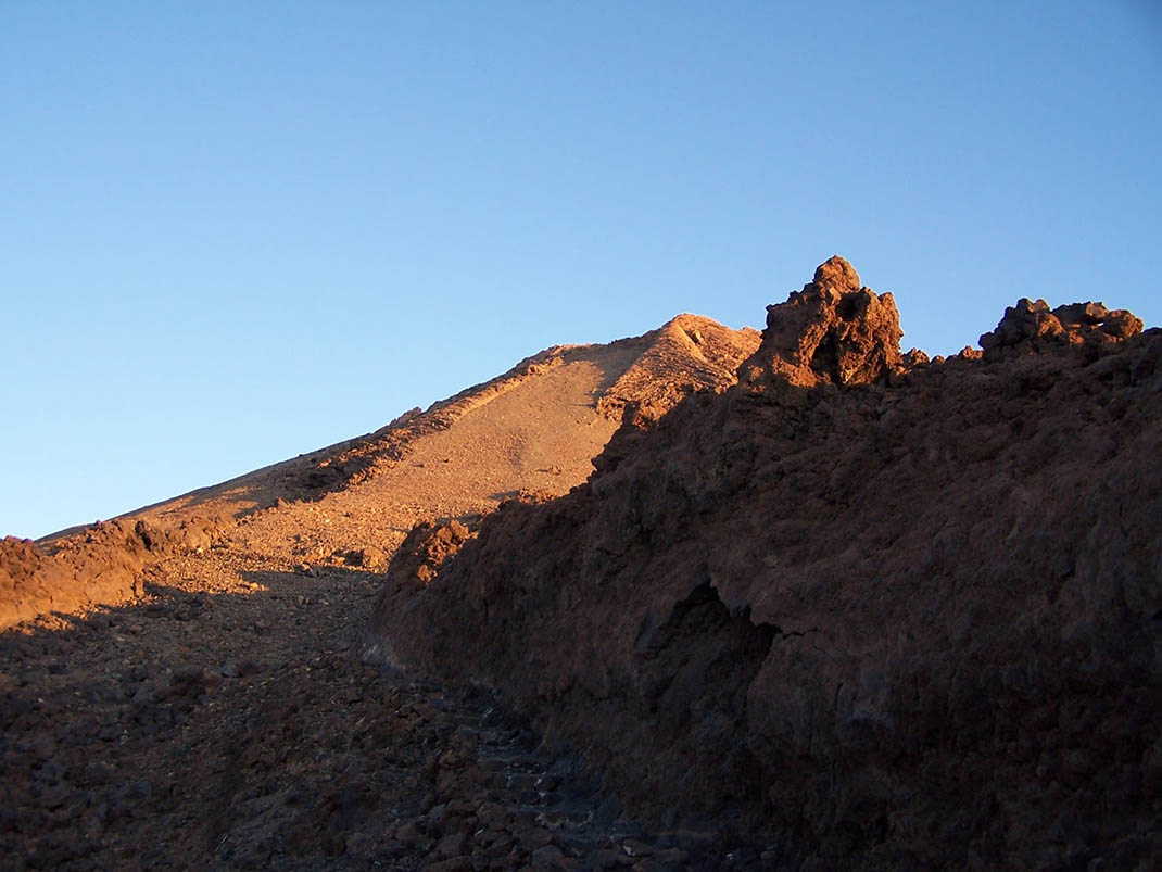
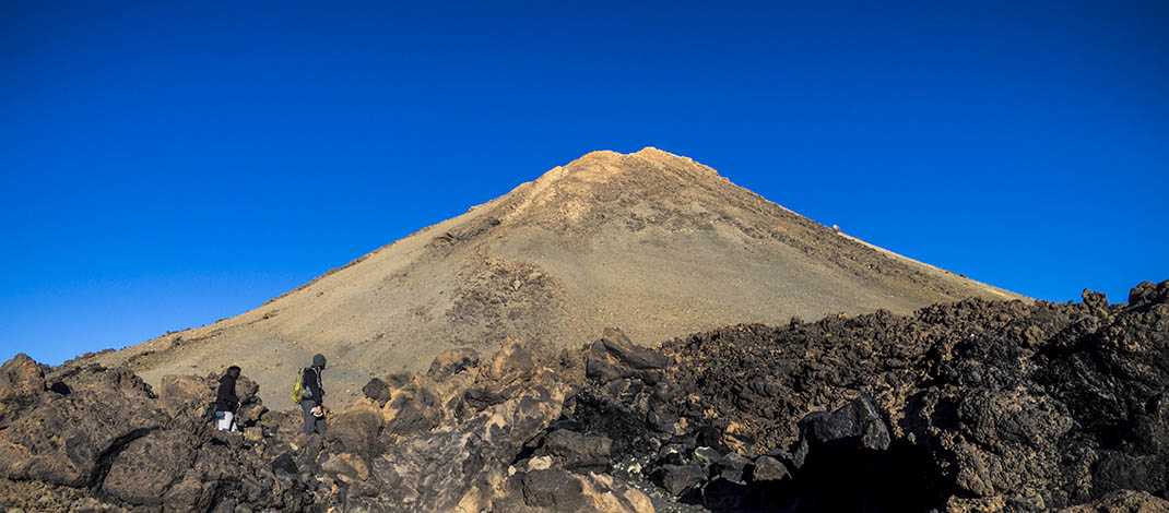
Although it is short and well-maintained, the steepness of this trail makes it very challenging. It has gradients of up to 60% and starts at an altitude of 3,550 m above sea level. We therefore recommend that you proceed slowly and stop frequently, whenever you need to. 

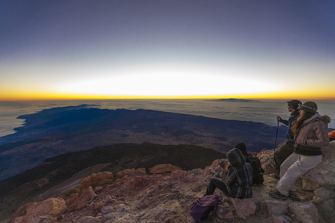
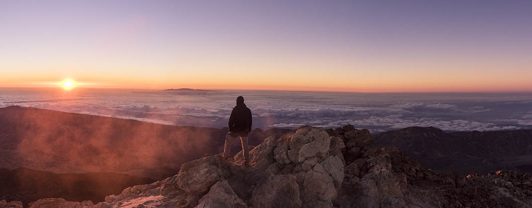
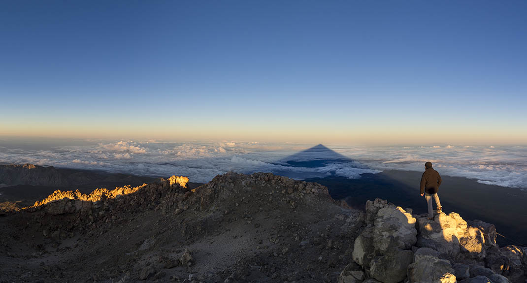
Once at the top, if there are not too many clouds, your efforts will be rewarded by magnificent panoramic views of Tenerife and other Canary Islands. 

The trail is dedicated to Telesforo Bravo, a distinguished Canarian geologist considered by many to be the father of volcanology in the Canary Islands. 

Near the crater you will see fumaroles that are a reminder that the volcano is still alive. And, although it may seem surprising, this place is also home to animal and plant species that have adapted to its unique ecological conditions. 

For example, around the fumaroles you can find the very rare Teide edelweiss (Laphangium teydeum), an endemic plant that has adapted to the humidity and heat. You may also spot some animals that feed on the small invertebrates, dead or alive, carried across the summit by the wind.

Tips

  • Always stay on the marked trail and do not enter private property, hunting grounds, water galleries, wells or caves.  
  • Pay special attention when crossing or walking along trails used by bicycles, horses or motor vehicles and when walking in ravines with water courses.
  • Avoid direct encounters with potentially dangerous animals, such as livestock, beehives, and dogs. 
  • Proceed with caution and watch for obstacles, loose rocks, uneven terrain or steep slopes to avoid accidents and falls. 
  • Check out our guide to hiking in Tenerife and, if necessary, contact the emergency services by calling 112.
Recommendations and tips

Permits

This trail requires a mandatory prior authorisation for all visitors.

Every Monday at 7:00 am (Canary Islands time) a new week will be displayed so that booking can always be done 28 days in advance.

IMPORTANT:

If you wish to reach the starting point of the PNT 10 Telesforo Bravo trail on foot instead of using the Cable Car, via trails PNT 07 Montaña Blanca – La Rambleta, PNT 09 Teide – Pico Viejo – Mirador de Las Narices del Teide or PR TF 41 El Socorro – Pico Teide, you must obtain an additional permit. This permit can be requested from the information page of each trail on Tenerife ON, and you must also have the mandatory equipment.

The time slots between 9:00 a.m. and 5:00 p.m. coincide with the cable car’s operating hours. However, the use and operation of the cable car are not linked to the permit for access to the Telesforo Bravo trail. For this reason, please note that the authorisation is valid only for the specific time slot and date stated on the permit, regardless of whether or not the cable car is in operation on that day.

More information

Technical information sheet

Route information

Walking route

Check your fitness level

Tenerife ON

Linear

0,66 km

0 h 55 m *

  • Altitude gain:182,54 m

  • Altitude loss:11,49 m

  • Maximum altitude:3.714,50 m

  • Minimum altitude:3.542,42 m

Signage

Route code

PNT-10

Signposts and waymarkers with the code of the trail on dark green panels.

Signage

Availability and permits

Reserva plazas

Individuals

Requiere reserva previa. Esta reserva no está vinculada al funcionamiento del Teleférico, cuyo horario es de 09:00 a 17:00 horas. No se permiten cambios en los tramos horarios autorizados.

Reserva plazas

Companies and entities

Autorización obligatoria para guías y profesionales que acompañen a los grupos siempre que estén acreditados por el Parque Nacional del Teide y cumplan con la legislación vigente.

Read the booking conditions

Number of people

* The marked fields are required

Select the activity day

  • Day with available slots
  • Day with no available slots
  • Blocked day
  • Places available for people Places available for people

Route map and profile

Elevation profile

Difficulty

Medium *MIDE safe mountain criteria

  • Maximum altitude:3.714,50 m

  • Minimum altitude:3.542,42 m

Connections with other routes

How to get to route start point

La Rambleta.

La Rambleta only accessible via the Teide cable car or on foot from Montaña Blanca, Los Roques de García or Las Narices del Teide. 

La Rambleta only accessible via the Teide cable car or on foot from Montaña Blanca, Los Roques de García or Las Narices del Teide. 

How to get to route end point

Pico del Teide.

Pico del Teide only accessible on foot with prior authorisation

Pico del Teide only accessible on foot with prior authorisation

Municipalities passed through

  • La Orotava

Weather

Today, sunday, in La Orotava


Clouds
Wind

13 km/h

Temperature

23ºC Maximum

22ºC Minimum

Rain

0%

3 day forecast

monday

23ºC Maximum

18ºC Minimum

tuesday

24ºC Maximum

19ºC Minimum

wednesday

24ºC Maximum

19ºC Minimum

Places of interest

These are some of the points of interest you can find along this route.

Rock

Pico Teide

Pico Teide is the highest point in Spain, and can only be climbed with prior authorisation, as...