ePrivacy and GPDR Cookie Consent management by TermsFeed Privacy Policy and Consent Generator PNT 01 La Fortaleza

PNT 01 La Fortaleza

PNT-01

Parque Nacional del Teide

La Fortaleza
La Fortaleza
La Fortaleza
La Fortaleza
La Fortaleza
La Fortaleza

Difficulty: Low

Description

With little elevation gain at high altitude, this route is perfect for observing the most characteristic flora and fauna of the Teide National Park. 

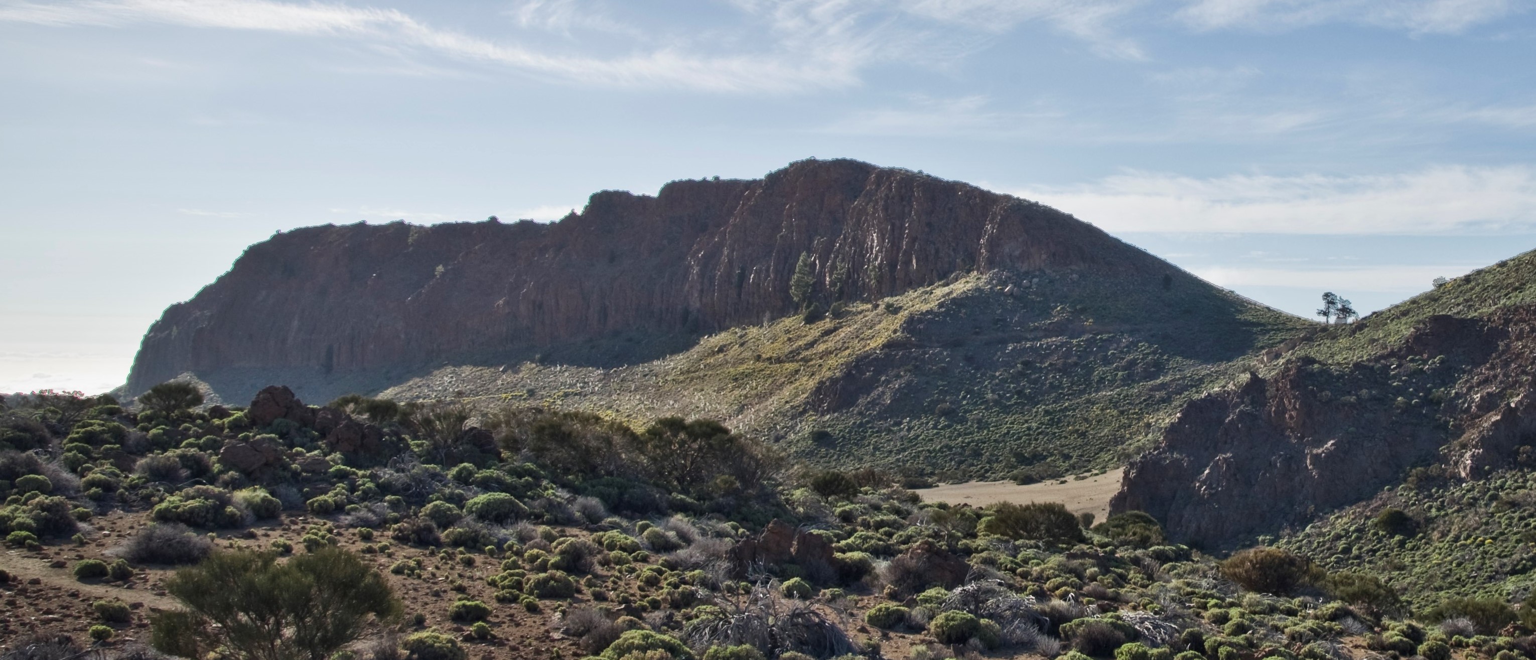
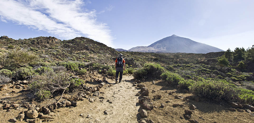
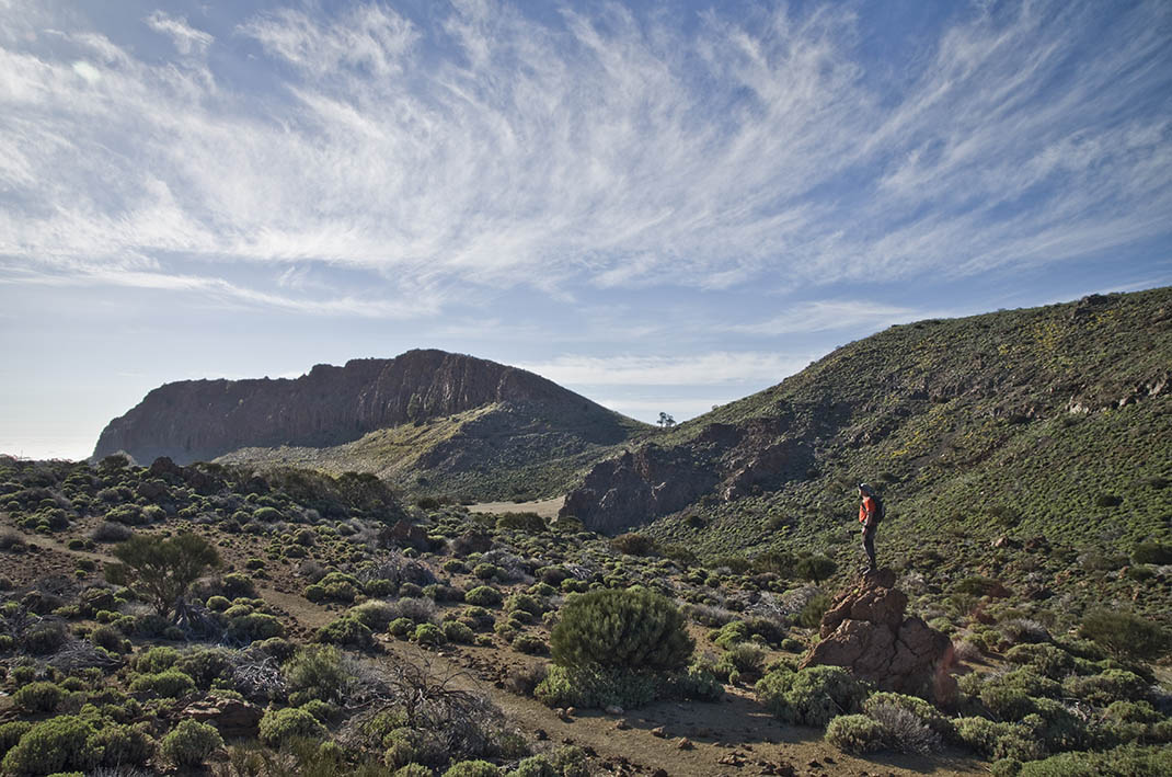
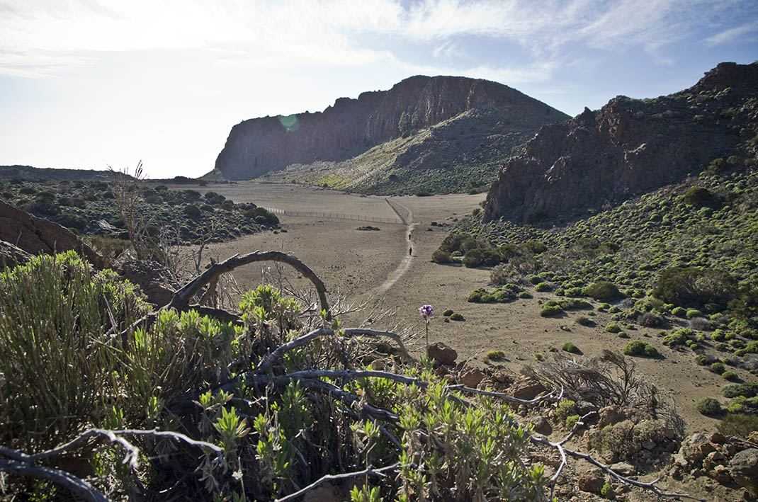
It starts at the Portillo Visitor Centre, inside the park, and heads north-west, reaching Cañada de Los Guancheros and ending at the rock face of La Fortaleza. 

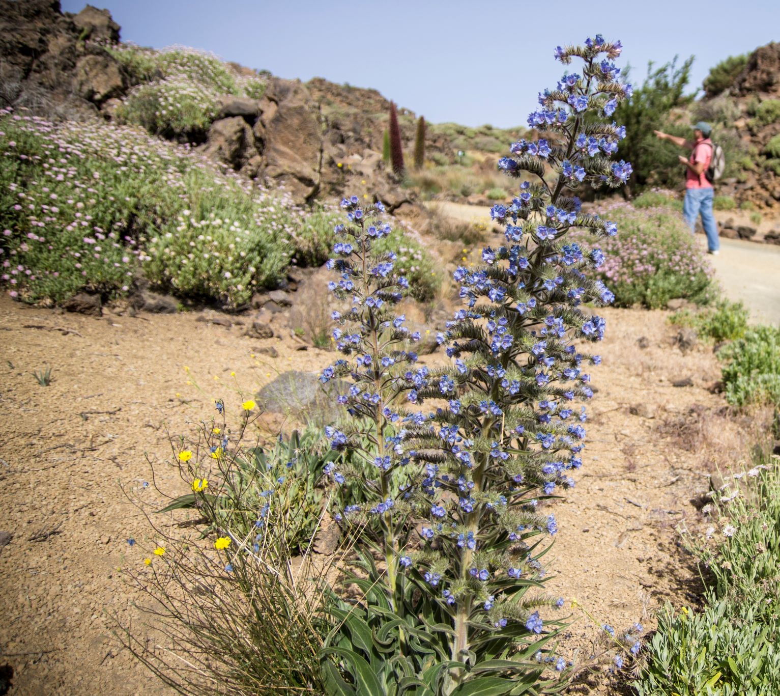
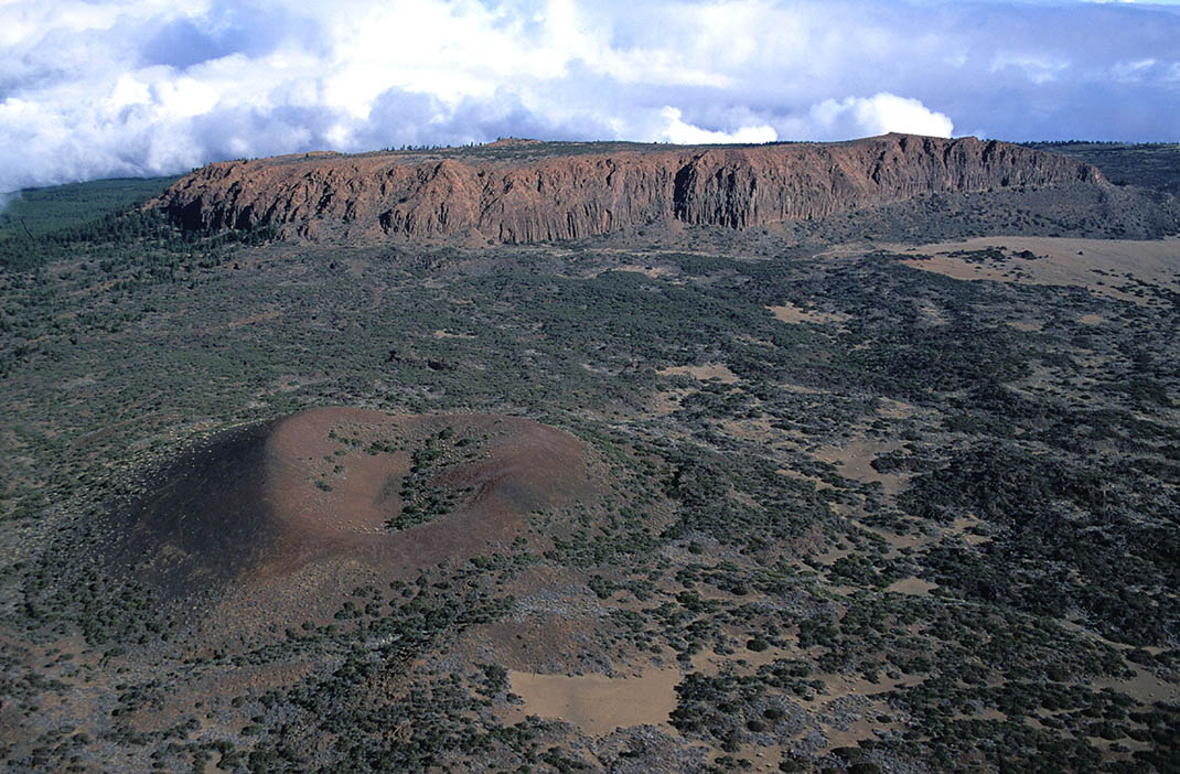
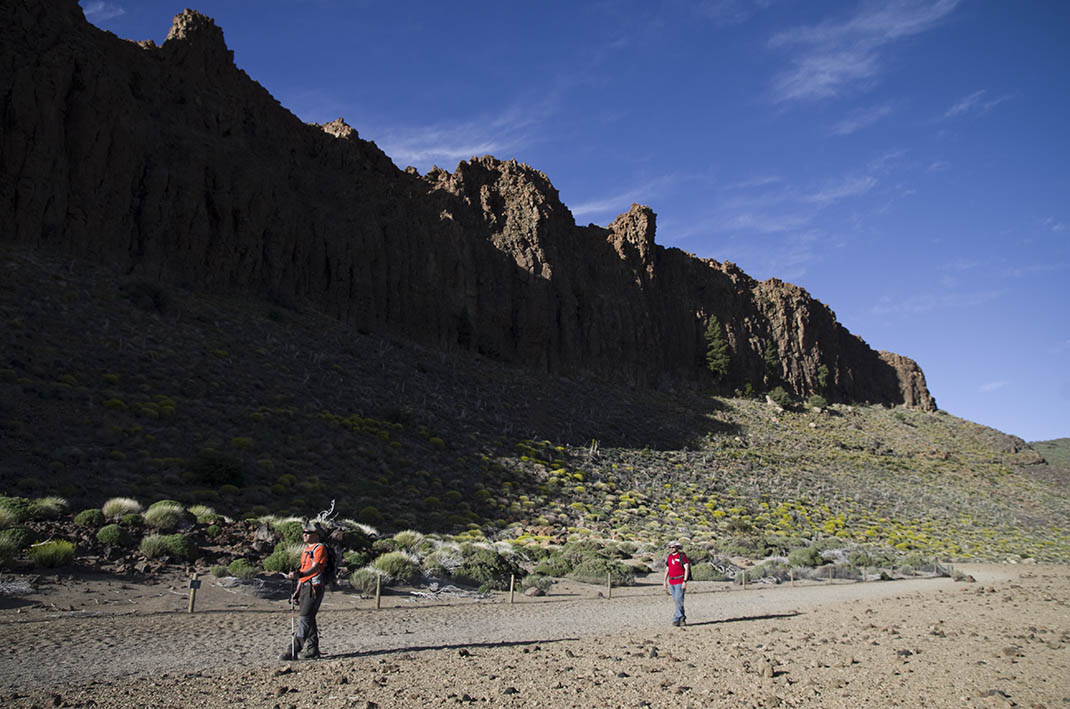
The well-signposted route takes you past mounds of pumice stone from the eruptions of Montaña Blanca. You will also see plants such as Teide white broom (Spartocytisus supranubius), Teide sticky broom or codeso (Adenocarpus viscosus), Canary Islands juniper and Canary Island pines at the base of La Fortaleza, a rusty-brown massif and remnant of the Cañadas Edifice that bears witness to the vast scale of this part of the island in the distant past.

Tips

  • Always stay on the marked trail and do not enter private property, hunting grounds, water galleries, wells or caves.  
  • Pay special attention when crossing or walking along trails used by bicycles, horses or motor vehicles and when walking in ravines with water courses.
  • Avoid direct encounters with potentially dangerous animals, such as livestock, beehives, and dogs. 
  • Proceed with caution and watch for obstacles, loose rocks, uneven terrain or steep slopes to avoid accidents and falls.
  • Check out our guide to hiking in Tenerife and, if necessary, contact the emergency services by calling 112.


Recommendations and tips

Permits

Free access for all visitors, no reservation required.

More information

Technical information sheet

Route information

Walking route

Tenerife ON

Linear

5,48 km

2 h 15 m

121,26 m

276,33 m

One way with fitness level 3/5

  • Altitude gain:121,26 m

  • Altitude loss:276,33 m

  • Maximum altitude:2.083,63 m

  • Minimum altitude:1.899,72 m

Signage

Route code

PNT-01

Signposts and waymarkers with the code of the trail on dark green panels.

Signage

Route map and profile

Elevation profile

Difficulty

Low *MIDE safe mountain criteria

  • Maximum altitude:2.083,63 m

  • Minimum altitude:1.899,72 m

Connections with other routes

How to get to route start point

El Portillo Visitor Centre, Carretera General del Teide (TF-21), km 32.1.

Bus numbers 348 and 342, Centro de Visitantes bus stop code 5243. TITSA

Parking spaces are available at the Visitor Centre, with reserved areas for people with reduced mobility.

How to get to route end point

La Cuesta de La Fortaleza.

Only accessible on foot.

Only accessible on foot.

Municipalities passed through

  • La Orotava
  • San Juan de la Rambla

Protected Areas

Transit

Parque Nacional del Teide

The Teide National Park is the best exampleof the high-mountain landscape of the Canary Islands.  It is a breathtaking setting where you can learn about some of the most spectacular volcanic ...

Discover the Protected Area
Parque Nacional del Teide

Transit

Parque Natural de la Corona Forestal

The Corona Forestal is the largest protected natural area in the Canary Islands, one of the most extensive forests on the islands, the lungs of Tenerife and the gateway to Mount Teide.  As its name ...

Discover the Protected Area
Parque Natural de Corona Forestal

Weather

Today, monday, in La Orotava


Clouds
Wind

2 km/h

Temperature

19ºC Maximum

14ºC Minimum

Rain

0%

3 day forecast

tuesday

20ºC Maximum

14ºC Minimum

wednesday

21ºC Maximum

16ºC Minimum

thursday

21ºC Maximum

16ºC Minimum

Places of interest

These are some of the points of interest you can find along this route.

La_Fortaleza
Rock

Risco de la Fortaleza (crags)

Striking rusty-brown rock formation that is the only remnant left of the ancient Cañadas Edifice...

Jardin_Botanico_Portillo
Monumental tree

El Portillo Botanical Garden

This garden, located in the Teide National Park, occupies a 4-hectare plot of land and was...