ePrivacy and GPDR Cookie Consent management by TermsFeed Privacy Policy and Consent Generator PR TF 40 Ladera de Tigaiga

PR TF 40 Ladera de Tigaiga

PR-TF 40

El Realejo Alto

Incident Incident

Route temporarily closed - Works

Obras en sendero para su reparación tras el incendio del verano de 2022

Route temporarily closed - Works

Obras en sendero para su reparación tras el incendio del verano de 2022

Route temporarily closed - Warnings (fire, wind, etc.)

Itinerario cerrado debido al incendio forestal del verano de 2023

Ladera de Tigaiga
Ladera de Tigaiga
Ladera de Tigaiga
Ladera de Tigaiga
Ladera de Tigaiga
Ladera de Tigaiga

Difficulty: High

Description

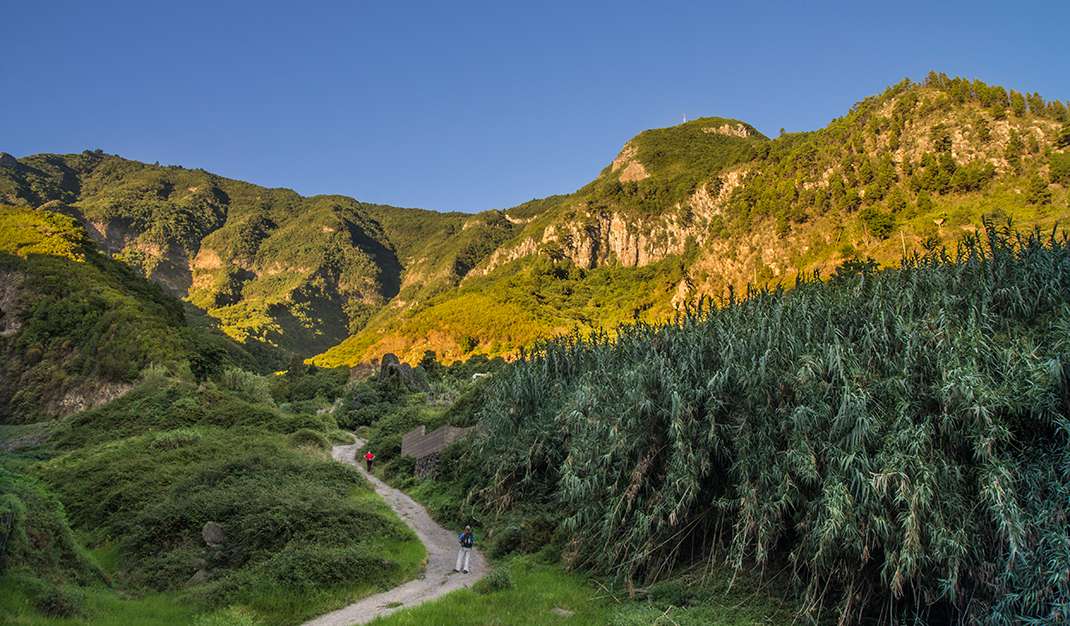
This very steep and difficult trail runs along the Tigaiga mountainside, an impressive geological structure in the form of cliff faces flanked by ravines. 

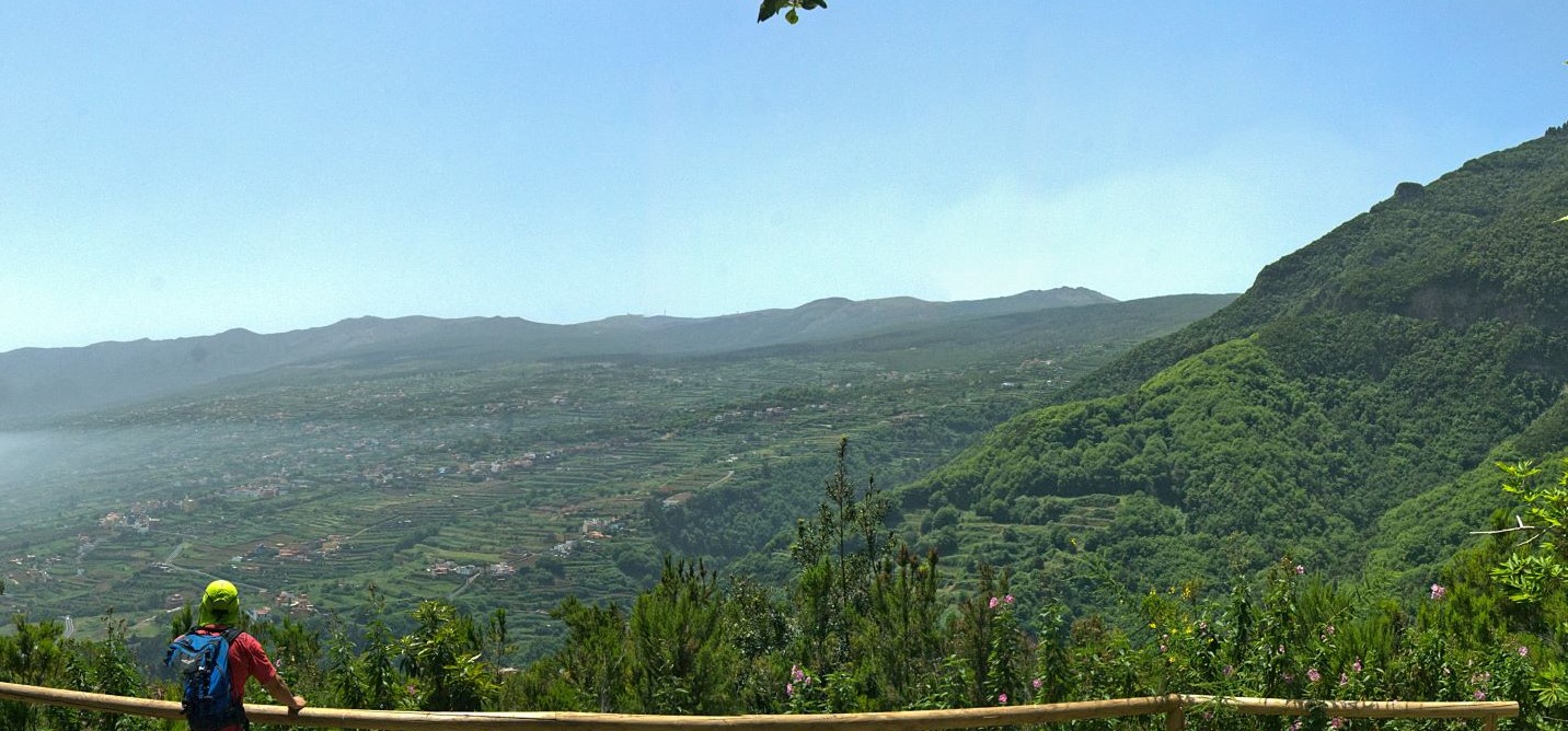
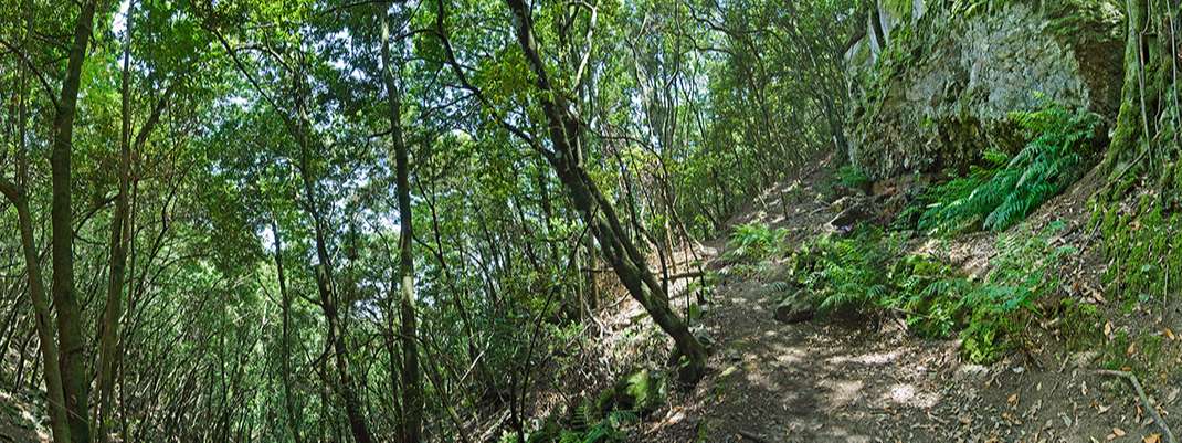
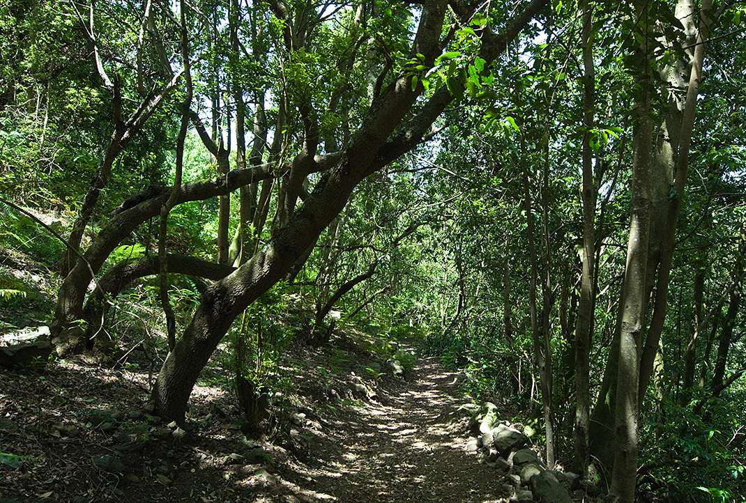
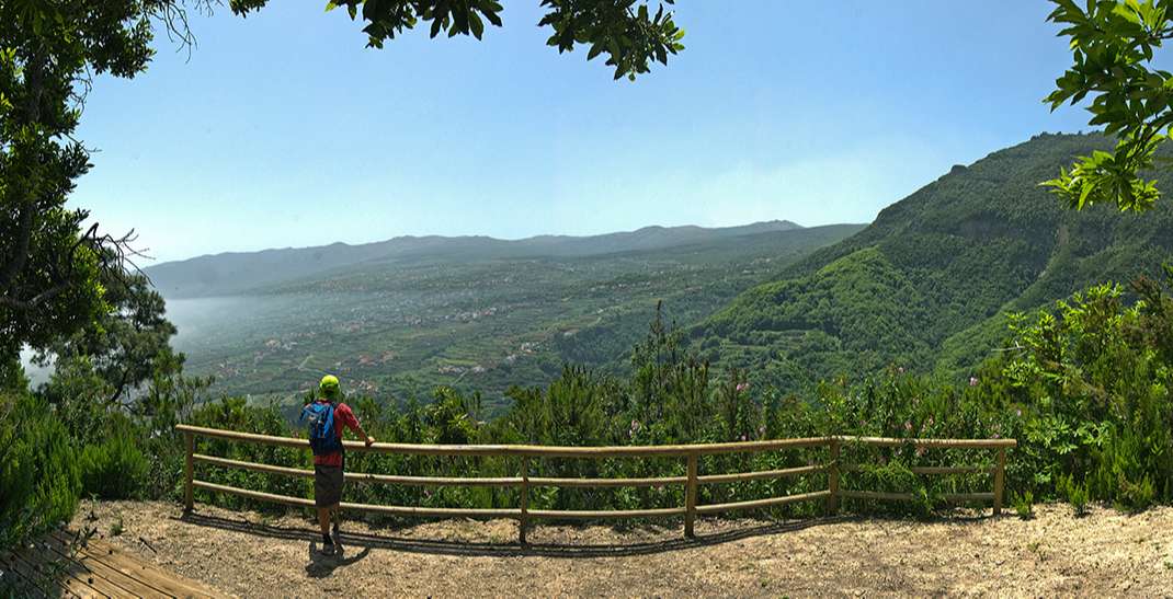
The route runs through laurel and pine forests in an area rich in flora and fauna endemic to the island and offers impressive views of the Orotava Valley and Mount Teide. 

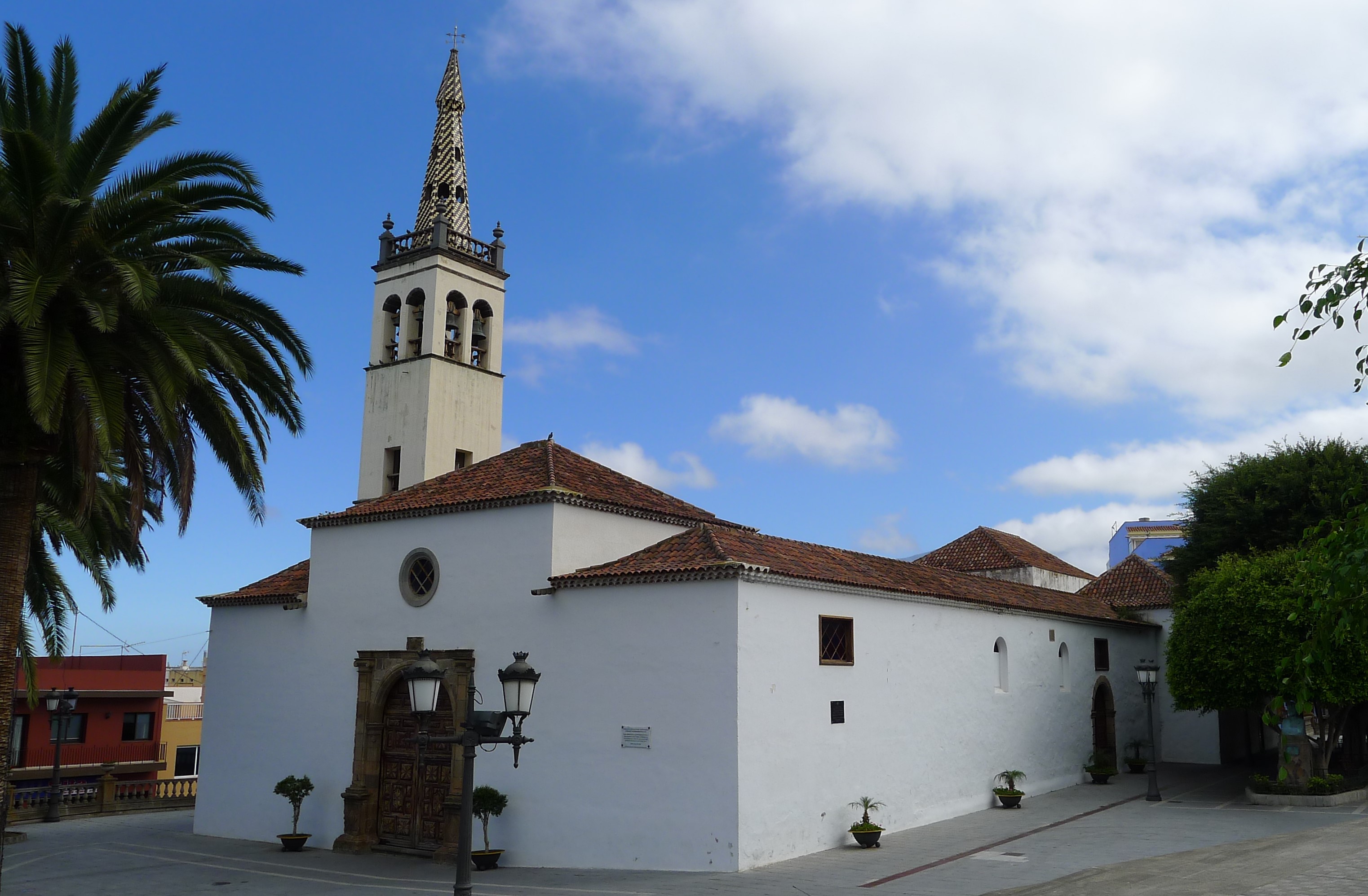
It starts at the Santiago Apóstol church square, and from there it follows Calle del Medio de Arriba until it enters Barranco de La Calera. 

You will pass the Caserío de La Florida and turn left to return to the ravine, arriving at an unmarked crossroads, where you should turn right. At this point you will enter a unique forest of til trees (Ocotea foetens), where the ancient Til de los Pavos is particularly noteworthy for its size and longevity. 

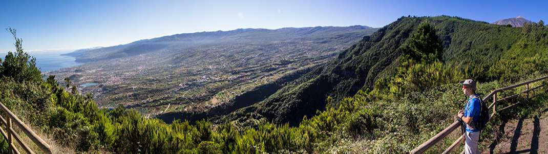
When you have walked more than 4 km, you will reach the Chanajiga Recreational Area and then Corral Quemado. If you continue on to the Risco de Miguel rest area, you will come across the plaque commemorating Enrique Talg, a pioneering entrepreneur in sustainable tourism. From here you can enjoy breathtaking views of the Orotava Valley. 

The next point on the route is El Asomadero viewpoint, which, in addition to the valley, offers an exceptional panoramic view of Mount Teide. 

From there, the path leads you to Barranco del Garabato, which takes you back to the starting point.

Tips

  • Always stay on the marked trail and do not enter private property, hunting grounds, water galleries, wells or caves.
  • Pay special attention when crossing or walking along trails used by bicycles, horses or motor vehicles and when walking in ravines with water courses.
  • Avoid direct encounters with potentially dangerous animals, such as livestock, beehives, and dogs.
  • Proceed with caution and watch for obstacles, loose rocks, uneven terrain or steep slopes to avoid accidents and falls. 
  • Check out our guide to hiking in Tenerife and, if necessary, contact the emergency services by calling 112.


Recommendations and tips

Guides

No data available

Permits

  • [TEMPORARY MEASURE] Free access without authorisation or reservation for natural or legal entities of a public or private nature, both non-profit (town councils, schools, associations, clubs, etc.) and for-profit (active tourism companies), until 31 December 2024 as established in the Resolution.
  • Free access for all other visitors, no reservation required.
  • Email for enquiries - This email address is being protected from spambots. You need JavaScript enabled to view it.
More information

Technical information sheet

Route information

Walking route

Tenerife ON

Circular

14,75 km

5 h 35 m

1.652,72 m

1.652,72 m

  • Altitude gain:1.652,72 m

  • Altitude loss:1.652,72 m

  • Maximum altitude:1.266,89 m

  • Minimum altitude:350,81 m

Signage

Route code

PR-TF 40

Posts and signs displaying the PR code and yellow and white marks.

Signage

Route map and profile

Elevation profile

Difficulty

High *MIDE safe mountain criteria

  • Maximum altitude:1.266,89 m

  • Minimum altitude:350,81 m

Connections with other routes

  • /

How to get to route start point

Avenida de Los Remedios, Realejo Alto.

Bus numbers 353 and 354, Viera y Clavijo bus stop code 4120. TITSA

Parking spaces available in the town.

How to get to route end point

Avenida de Los Remedios, Realejo Alto.

Bus numbers 353 and 354, Viera y Clavijo bus stop code 4120. TITSA

Parking spaces available in the town.

Municipalities passed through

  • Los Realejos

Protected Areas

Transit

Parque Natural de la Corona Forestal

The Corona Forestal is the largest protected natural area in the Canary Islands, one of the most extensive forests on the islands, the lungs of Tenerife and the gateway to Mount Teide.  As its name ...

Discover the Protected Area
Parque Natural de Corona Forestal

Weather

Today, thursday, in Los Realejos


Clear skies
Wind

1 km/h

Temperature

23ºC Maximum

17ºC Minimum

Rain

0%

3 day forecast

friday

21ºC Maximum

17ºC Minimum

saturday

19ºC Maximum

15ºC Minimum

sunday

19ºC Maximum

15ºC Minimum

Places of interest

These are some of the points of interest you can find along this route.

Santiago_Apostol_Realejos
Heritage of Cultural Interest

Iglesia de Santiago Apóstol (Church of Saint James the Apostle) - BIC (Asset of Cultural Interest) Monument

The fact that a place of worship stands on this spot is linked to the surrender and baptism of...

Conjunto_Historico_Realejo_Alto
Heritage of Cultural Interest

El Realejo Alto Conservation Area - BIC (Asset of Cultural Interest) Conjunto histórico (Conservation Area)

This historic old town was founded in the final stages of the conquest of the island by the...

Ravine

Barranco La Lora

Major ravine in Icod el Alto, which runs along the slopes of Tigaiga.

...
Oficina_Turismo_Realejos
Tourist Information Point

Los Realejos Municipal Tourist Office

922346181 turismo@losrealejos.travel
Viera_y_Clavijo_Realejos
Heritage of Cultural Interest

Birthplace of Viera y Clavijo

The historical value of this building lies in the fact that it was the birthplace of the Canary...

Rock

Ladera de Tigaiga

Ladera de Tigaiga is a majestic landform that boasts lush laurel forests. This impressive...