ePrivacy and GPDR Cookie Consent management by TermsFeed Privacy Policy and Consent Generator PNT 36 Alto de La Fortaleza

PNT 36 Alto de La Fortaleza

PNT-36

Parque Nacional del Teide

Alto de La Fortaleza

Difficulty: Low

Description

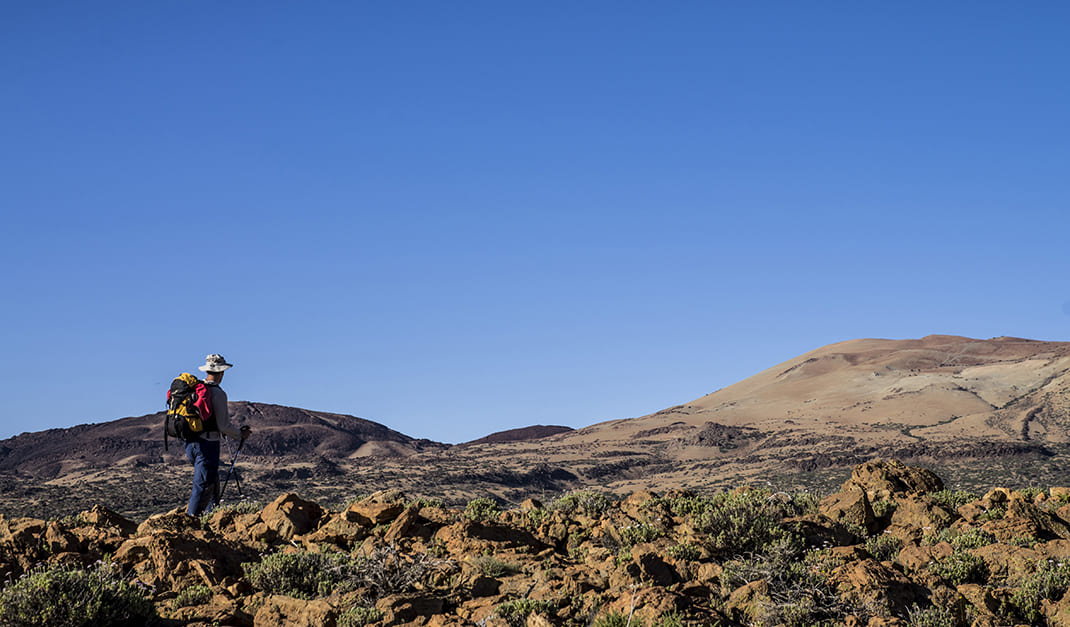
This trail sets off from La Degollada del Cedro, between La Fortaleza and El Cabezón, and runs across the plateau of Alto de La Fortaleza. 

If you walk this route in the evening you can catch a spectacular sunset as the sun sinks behind the island of La Palma, marking its silhouette on the horizon. 

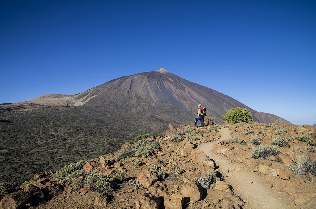
You will also see the dense mass of Canary Island pine forest that stretches unbroken from the back of La Fortaleza to the foothills of the Teno Massif, along the Abeque ridge. 

The vegetation here is stunted but awash with colour in spring, mainly populated with species more typical of Canary Island mountaintop areas than of the adjacent pine forest. 

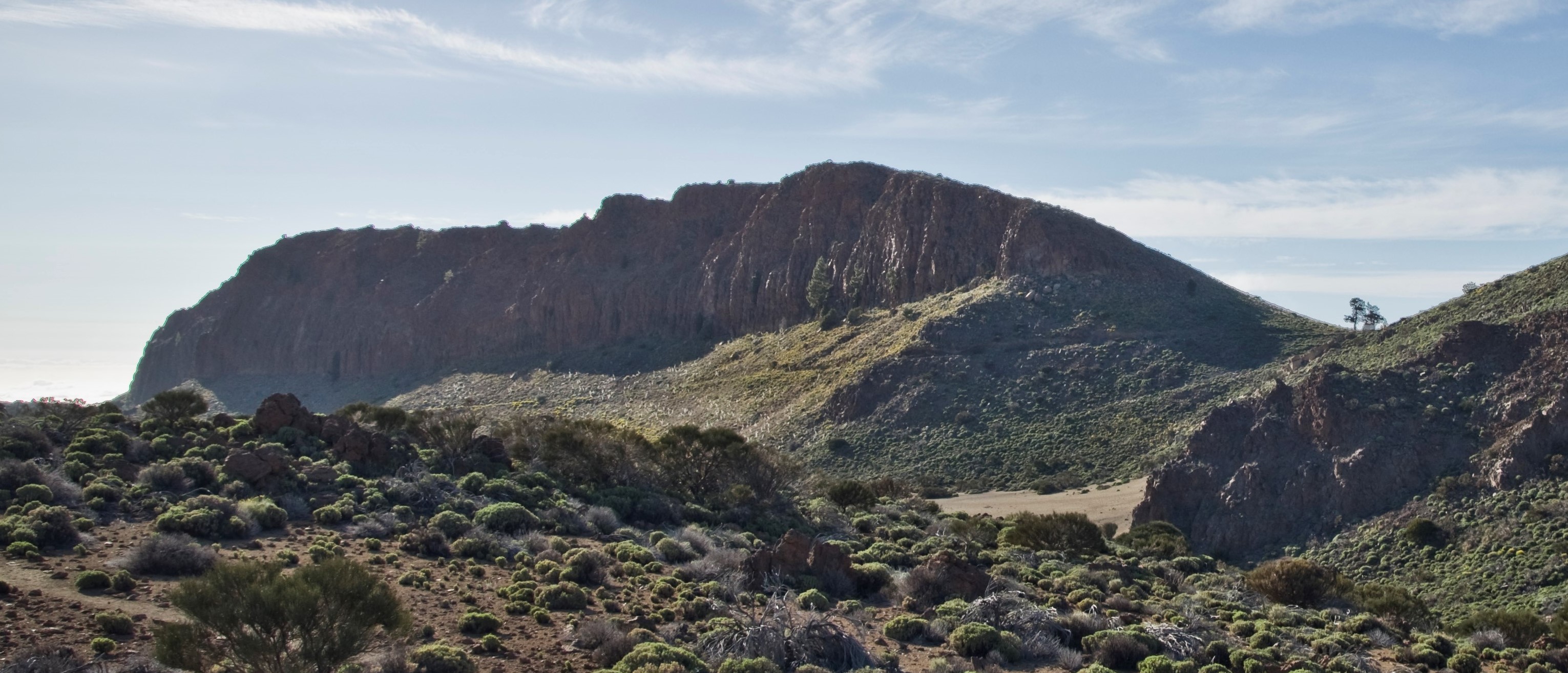
The southern section of the trail runs along the edge of the rocky outcrop of La Fortaleza, providing a natural balcony with exceptional views some 100m above La Cañada de Los Guancheros, at the highest point of the route (2135 m).

Tips

  • Always stay on the marked trail and do not enter private property, hunting grounds, water galleries, wells or caves.
  • Pay special attention when crossing or walking along trails used by bicycles, horses or motor vehicles and when walking in ravines with water courses.
  • Avoid direct encounters with potentially dangerous animals, such as livestock, beehives, and dogs.
  • Proceed with caution and watch for obstacles, loose rocks, uneven terrain or steep slopes to avoid accidents and falls. 
  • Check out our guide to hiking in Tenerife and, if necessary, contact the emergency services by calling 112.


Recommendations and tips

Permits

Free access for all visitors, no reservation required.

More information

Technical information sheet

Route information

Walking route

Tenerife ON

Circular

2,19 km

1 h 10 m

92,65 m

92,65 m

One way with fitness level 3/5

  • Altitude gain:92,65 m

  • Altitude loss:92,65 m

  • Maximum altitude:2.161,76 m

  • Minimum altitude:2.085,35 m

Signage

Route code

PNT-36

Signposts and waymarkers with the code of the trail on dark green panels.

Signage

Route map and profile

Elevation profile

Difficulty

Low *MIDE safe mountain criteria

  • Maximum altitude:2.161,76 m

  • Minimum altitude:2.085,35 m

Connections with other routes

How to get to route start point

Cruz de Fregel.

Trailhead only accessible on foot from trails PNT 29 and PR TF 41.

Trailhead only accessible on foot from trails PNT 29 and PR TF 41.

How to get to route end point

Cruz de Fregel.

End point only accessible on foot from trails PNT 29 and PR TF 41.

End point only accessible on foot from trails PNT 29 and PR TF 41.

Municipalities passed through

  • Los Realejos
  • San Juan de la Rambla

Protected Areas

Transit

Parque Nacional del Teide

The Teide National Park is the best exampleof the high-mountain landscape of the Canary Islands.  It is a breathtaking setting where you can learn about some of the most spectacular volcanic ...

Discover the Protected Area
Parque Nacional del Teide

Transit

Parque Natural de la Corona Forestal

The Corona Forestal is the largest protected natural area in the Canary Islands, one of the most extensive forests on the islands, the lungs of Tenerife and the gateway to Mount Teide.  As its name ...

Discover the Protected Area
Parque Natural de Corona Forestal

Weather

Today, saturday, in San Juan de la Rambla


Clouds
Wind

1 km/h

Temperature

18ºC Maximum

12ºC Minimum

Rain

0%

3 day forecast

sunday

17ºC Maximum

12ºC Minimum

monday

17ºC Maximum

12ºC Minimum

tuesday

19ºC Maximum

12ºC Minimum

Places of interest

These are some of the points of interest you can find along this route.

La_Fortaleza
Rock

Risco de la Fortaleza (crags)

Striking rusty-brown rock formation that is the only remnant left of the ancient Cañadas Edifice...