ePrivacy and GPDR Cookie Consent management by TermsFeed Privacy Policy and Consent Generator PNT 28 Chafarí

PNT 28 Chafarí

PNT-28

Parque Nacional del Teide

Information Information

Mouflon control

Before your visit, check the news to find out if this trail is closed for mouflon control operations. Here

Difficulty: Medium

Description

This trail climbs the slopes of Pico Viejo from the TF-38 road, just over a kilometre from Boca Tauce. 

It runs for the most part along the dirt track known as “Los Chircheros”, ascending through a landscape of abundant broom that has colonised the lava flows that descended from the top of Pico Viejo. 

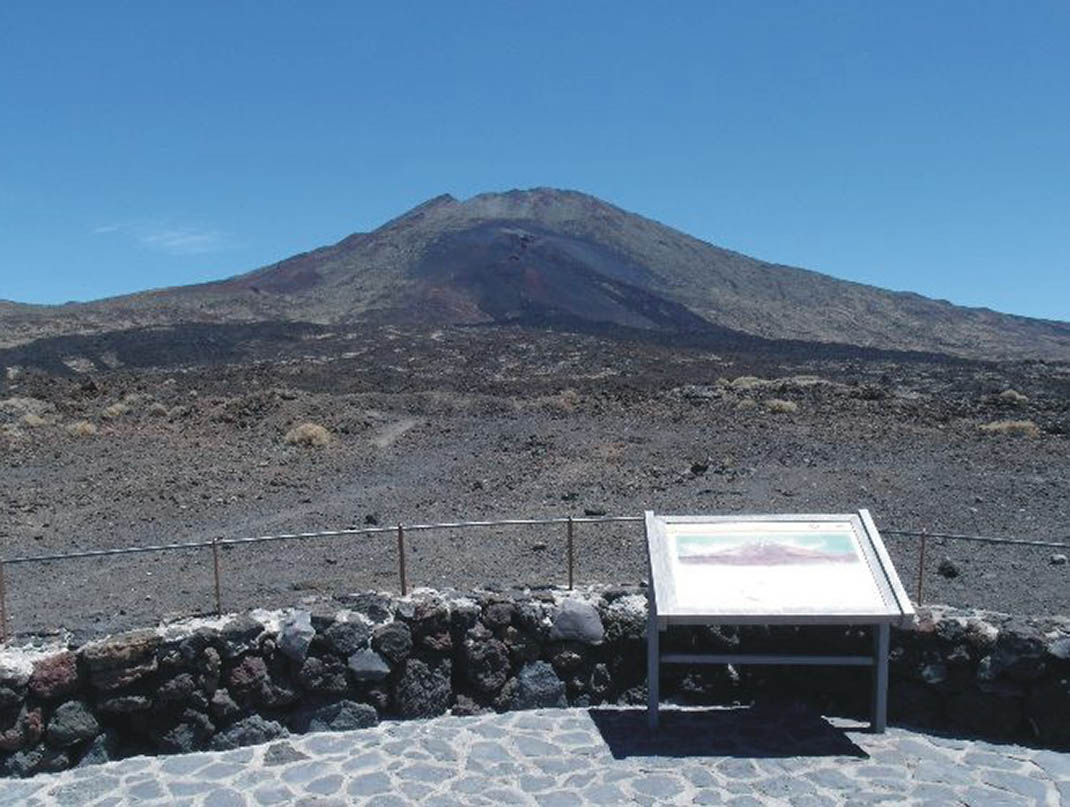
At the end of this forest track, you will begin to climb along a path of loose pyroclastic material from the eruption of Las Narices del Teide in 1798. 

This part of the trail is arduous, as progress is hampered by the loose rock underfoot and the steepness of the climb. 

The trail ends at the top of Las Narices del Teide at an altitude of 2752 m, where you will meet the PNT 09 trail (Teide - Pico Viejo). You can now continue climbing up to La Rambleta (3503 m) or descend to the Las Narices del Teide viewpoint on the TF-38 road.

Tips

  • Always stay on the marked trail and do not enter private property, hunting grounds, water galleries, wells or caves.
  • Pay special attention when crossing or walking along trails used by bicycles, horses or motor vehicles and when walking in ravines with water courses.
  • Avoid direct encounters with potentially dangerous animals, such as livestock, beehives, and dogs. 
  • Proceed with caution and watch for obstacles, loose rocks, uneven terrain or steep slopes to avoid accidents and falls. 
  • Check out our guide to hiking in Tenerife and, if necessary, contact the emergency services by calling 112.


Recommendations and tips

Permits

1.- Reservation Required

See more information here.

Check the "Availability and Permits" section on this page.

Access without a reservation may result in a fine.

Check more details here

⚠️ Important: Access to the final stretch to the summit of Mount Teide (Trail PNT 10 Telesforo Bravo) requires an additional permit.

See more information here.

2.- Mandatory clothing and equipment when there is no ice or snow

Check more details here

3.- Clothing and equipment required when the Resolution on preventive measures due to the presence of ice and snow is in force

Check more details here

4.- Reservation availability

📅 Every Monday at 07:00 a.m. (Canary Islands time), the available slots for the next 21 days are released. Dates shown in grey indicate they are not yet available.

More information

Technical information sheet

Route information

Walking route

Check your fitness level

Tenerife ON

Linear

6,60 km

3 h 5 m *

  • Altitude gain:756,03 m

  • Altitude loss:47,13 m

  • Maximum altitude:2.746,19 m

  • Minimum altitude:2.034,98 m

Signage

Route code

PNT-28

Signposts and waymarkers with the code of the trail on dark green panels.

Signage

Availability and permits

Reserva plazas

Individuals

Advance booking required

Reserva plazas

Companies and entities

Mandatory Authorisation for Legal Entities. Guides and professionals accompanying groups must be accredited by Teide National Park.

  • Day with available slots
  • Day with no available slots
  • Blocked day
  • Places available for people Places available for people
Read the booking conditions

Number of people

Check availability

Select the activity day

Route map and profile

Elevation profile

Difficulty

Medium *MIDE safe mountain criteria

  • Maximum altitude:2.746,19 m

  • Minimum altitude:2.034,98 m

Connections with other routes

How to get to route start point

Boca Tauce viewpoint, Carretera de Las Cañadas del Teide (TF-21), km 53.1.

Bus number 342, Boca Tauce bus stop code 7682. TITSA

Limited parking spaces at the viewpoint.

How to get to route end point

PNT-09 Teide - Pico Viejo - Narices del Teide Viewpoint.

Trailhead only accessible on foot from the PNT 09 trail.

Trailhead only accessible on foot from the PNT 09 trail.

Municipalities passed through

  • La Orotava

Protected Areas

Transit

Parque Nacional del Teide

The Teide National Park is the best exampleof the high-mountain landscape of the Canary Islands.  It is a breathtaking setting where you can learn about some of the most spectacular volcanic ...

Discover the Protected Area
Parque Nacional del Teide

Weather

Today, monday, in La Orotava


Clear skies
Wind

20 km/h

Temperature

21ºC Maximum

19ºC Minimum

Rain

0%

3 day forecast

tuesday

22ºC Maximum

17ºC Minimum

wednesday

23ºC Maximum

18ºC Minimum

thursday

24ºC Maximum

19ºC Minimum

Places of interest

These are some of the points of interest you can find along this route.

Rock

Las Narices del Teide Volcano

Las Narices del Teide (Teide’s Nostrils) is a volcano formed during the 1798 eruption and...