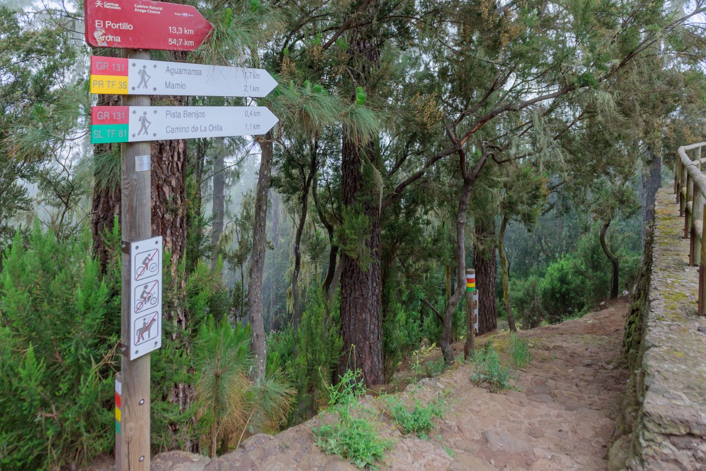
ePrivacy and GPDR Cookie Consent management by TermsFeed Privacy Policy and Consent Generator SL TF 81.1 Connection Orilla del Monte - Pista Benijos

SL TF 81.1 Connection Orilla del Monte - Pista Benijos

SL-TF 81.1

Aguamansa

SL TF 81.1 Conexion Orilla del Monte - Pista de Benijos

Difficulty: Low

Description

Variant of the SL TF 81 trail that turns off the Camino La Orilla del Monte 300 m from the start to take you on a shorter circular route to the Benijos track.

Tips

  • Always stay on the marked trail and do not enter private property, hunting grounds, water galleries, wells or caves.  
  • Pay special attention when crossing or walking along trails used by bicycles, horses or motor vehicles and when walking in ravines with water courses.
  • Avoid direct encounters with potentially dangerous animals, such as livestock, beehives, and dogs. 
  • Proceed with caution and watch for obstacles, loose rocks, uneven terrain or steep slopes to avoid accidents and falls. 
  • Check out our guide to hiking in Tenerife and, if necessary, contact the emergency services by calling 112.
Recommendations and tips

Guides

No data available

Permits

  • [TEMPORARY MEASURE] Free access without authorisation or reservation for natural or legal entities of a public or private nature, both non-profit (town councils, schools, associations, clubs, etc.) and for-profit (active tourism companies), until 31 December 2024 as established in the Resolution.
  • Free access for all other visitors, no reservation required.
  • Email for enquiries - This email address is being protected from spambots. You need JavaScript enabled to view it.
More information

Technical information sheet

Route information

Walking route

Tenerife ON

Linear

0,50 km

0 h 20 m

3,12 m

66,53 m

One way with fitness level 3/5

  • Altitude gain:3,12 m

  • Altitude loss:66,53 m

  • Maximum altitude:1.116,67 m

  • Minimum altitude:1.053,26 m

Signage

Route code

SL-TF 81.1

Posts and signs displaying the SL code and green and white marks.

Signage

Route map and profile

Elevation profile

Difficulty

Low *MIDE safe mountain criteria

  • Maximum altitude:1.116,67 m

  • Minimum altitude:1.053,26 m

Connections with other routes

How to get to route start point

Carretera General de Aguamansa. Camino La Orilla.

Bus numbers 345 and 346, La Caldera bus stop code 4253, at the start of the SL TF 81 trail. TITSA

Parking spaces available in the area.

How to get to route end point

Pista Benijos.

Bus numbers 345 and 346, La Caldera bus stop code 4253, at the start of the SL TF 81 trail. TITSA

Parking spaces available in the area.

Municipalities passed through

  • La Orotava

Protected Areas

Transit

Parque Natural de la Corona Forestal

The Corona Forestal is the largest protected natural area in the Canary Islands, one of the most extensive forests on the islands, the lungs of Tenerife and the gateway to Mount Teide.  As its name ...

Discover the Protected Area
Parque Natural de Corona Forestal

Weather

Today, monday, in La Orotava


Clouds
Wind

2 km/h

Temperature

19ºC Maximum

14ºC Minimum

Rain

0%

3 day forecast

tuesday

20ºC Maximum

14ºC Minimum

wednesday

21ºC Maximum

16ºC Minimum

thursday

21ºC Maximum

16ºC Minimum