ePrivacy and GPDR Cookie Consent management by TermsFeed Privacy Policy and Consent Generator BC-1.3 La Vica

BC-1.3 La Vica

BC-1.3

Las Lagunetas Protected Landscape, extension of route BC 1 to La Vica viewpoint.

Incident Incident

Route temporarily closed - Warnings (fire, wind, etc.)

Itinerario cerrado debido al incendio forestal del verano de 2023

La Vica
La Vica
La Vica
La Vica
La Vica

Description

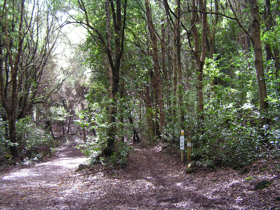
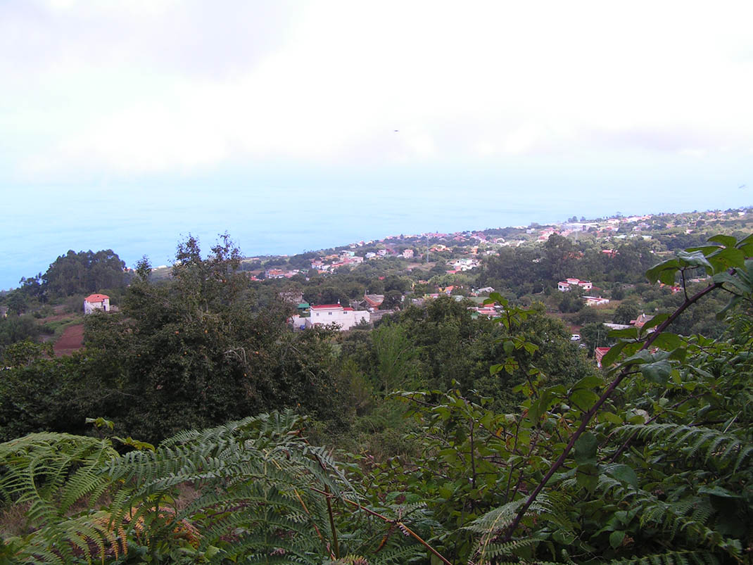
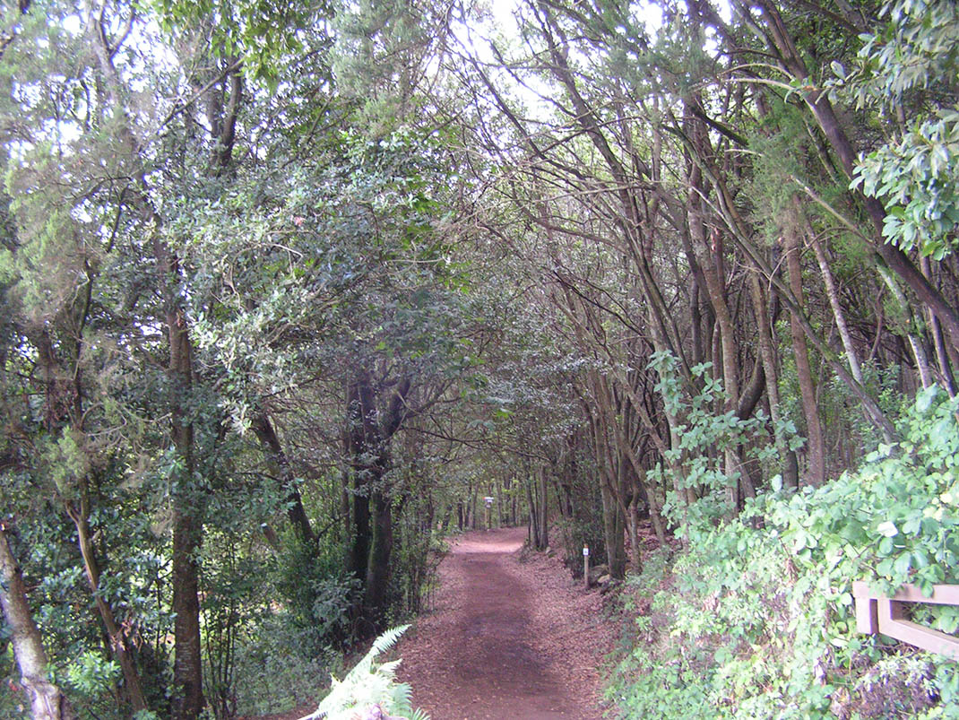
This forest trail takes you to the La Vica viewpoint, passing through an enchanted forest straight out of a fairy tale. 

It runs through the Las Lagunetas Protected Landscape, an environment of great ecological value that plays an essential role in recharging the island’s underground aquifers. 

Its monteverde forest is one of the healthiest and best preserved on the island of Tenerife, thanks to its exposure to the trade winds. The branches of its trees intertwine above the trail creating a natural canopy that provides a cool, fresh atmosphere to enjoy on warm summer days. 

Along the route you will be able to see rare species such as palo blanco (Picconia excelsa) and naranjero silvestre (Ilex perado), both of which are endemic to the Macaronesian region. And if you pay attention to where you are stepping, you will be able to make out part of the cobblestones that are still preserved in some sections of the Montaña del Pozo trail, remains of the ancient paths that used to link the different settlements of the island.

IBP Index: 3.

Tips

  • Always stay on the marked trail and do not enter private property, hunting grounds, water galleries, wells or caves.  
  • Be careful when walking along roads used by motor vehicles and hiking trails, and when crossing ravines with water courses.
  • Avoid direct encounters with potentially dangerous animals, such as livestock, beehives, and dogs. 
  • Proceed with caution and watch for obstacles, loose rocks, uneven terrain or steep slopes to avoid accidents and falls. 
  • Consult our good practice guide and, if necessary, contact emergency services by calling 112.
Recommendations and tips

Guides

No data available

Permits

  • Reservation obligatory for groups organised by for-profit and not-for-profit public and private entities and profit-making individuals. Link
  • T: 901 501 901 - 922 239 500.
  • Free access for all other users, alone or in a group, no reservation required.

Technical information sheet

Route information

Cycling and horse riding route

Tenerife ON

Linear

1,81 km

0 h 10 m

25,82 m

124,66 m

At an average speed of 14 km/h

  • Altitude gain:25,82 m

  • Altitude loss:124,66 m

  • Maximum altitude:1.022,90 m

  • Minimum altitude:924,06 m

Signage

Route code

BC-1.3

Orange posts and signs that include:

  • Official trail number.
  • Route direction.
  • Distance to points of interest.
  • Cyclist and horserider icons.
Signage

Route map and profile

Elevation profile

  • Maximum altitude:1.022,90 m

  • Minimum altitude:924,06 m

Connections with other routes

  • /

How to get to route start point

Route BC 1, Montaña del Pozo Trail, intersection with the Las Aguilillas trail, La Matanza de Acentejo.

No nearby service.

No parking spaces in the area.

How to get to route end point

Calle La Vica, end of the Montaña del Pozo trail, La Matanza de Acentejo.

No nearby service.

Parking spaces available in calle La Vica and La Vica viewpoint.

Municipalities passed through

  • La Matanza de Acentejo

Protected Areas

Transit

Paisaje Protegido de Las Lagunetas

The Las Lagunetas Protected Landscape is situated on the north side of the Pedro Gil ridge, in the north-east of Tenerife.  This ridge was formed over the course of numerous phases of eruption less ...

Discover the Protected Area
Paisaje Protegido de Las Lagunetas

Weather

Today, friday, in La Matanza de Acentejo


Clouds
Wind

15 km/h

Temperature

18ºC Maximum

14ºC Minimum

Rain

268%

3 day forecast

saturday

19ºC Maximum

15ºC Minimum

sunday

19ºC Maximum

17ºC Minimum

monday

20ºC Maximum

16ºC Minimum