


Markings along cycling and riding trails
Tenerife’s natural areas offer 18 routes to discover by bicycle or on horseback, identifiable by their orange signage.

Tenerife’s natural areas offer 18 routes to discover by bicycle or on horseback, identifiable by their orange signage.
Classification and names of trails
The forest trail network dedicated to cyclists and riders is made up of 5 main routes and 13 secondary extensions.
Main routes
The code attributed to these routes is made up of the letters B (for bicycles) and C (for horses - caballo in Spanish), followed by the route number (BC 1, BC 2, BC 5, etc.).
Secondary extensions
In these instances, the code contains a second number after a decimal point (for example, BC 1.2 is extension 2 of route BC 1).
Types of signage
Para guiarte a través de la red de pistas para ciclistas y jinetes encontrarás señales en 3 formatos diferentes:
 |
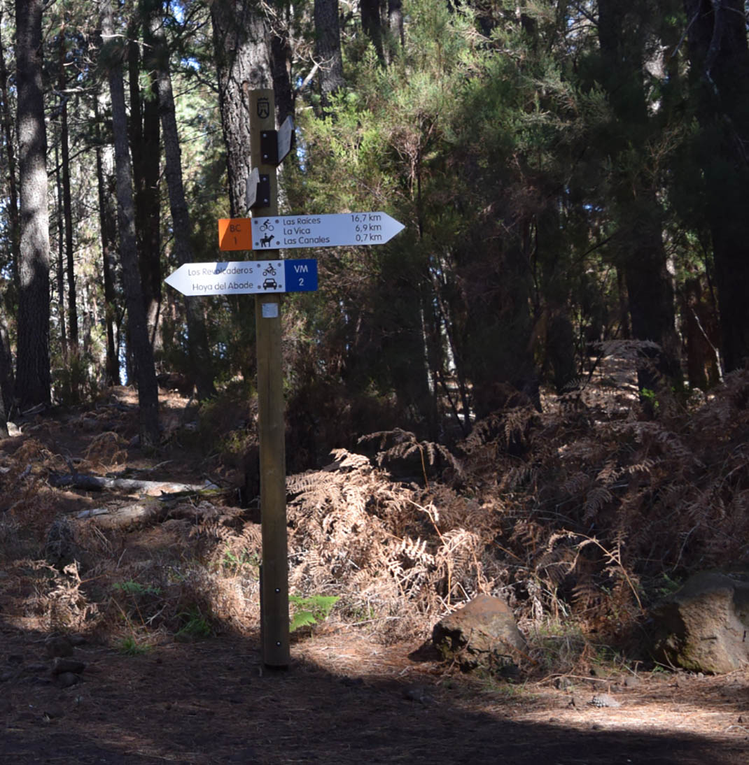
Indicative signageWhite signs with an orange square and icons of a cyclist and a horse and rider at the beginning of each route and at intersections between trails. On these signs you can see:
|
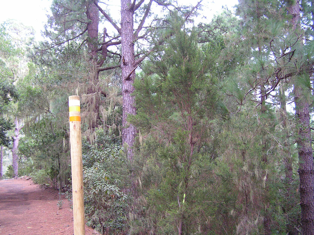 |
PostsMedium-sized post with an orange strip located at 25 metres from each intersection with other routes, including routes for bicycles and horses, motor vehicles and hiking. Please pay special attention when you come across these signs so as to avoid collisions and accidents. |
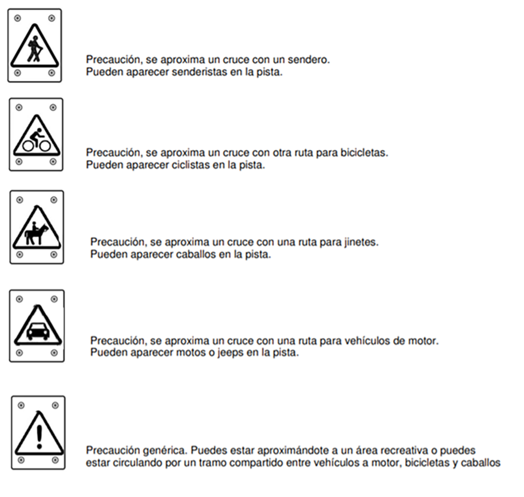 |
Warning signsSignage located near an intersection of trails which indicates the type of users (walkers, bicycles, horses, motor vehicles, or a combination of these), encouraging you to pay special attention. |
Use of shared sections of trail
This network contains sections of trail that are also used by motor vehicles; therefore you should be especially careful.
Outside of these sections you may also come across authorised forestry management vehicles, as well as runners and walkers, all of which are activities that are authorised on all of the trails within Tenerife’s protected natural areas.
In order to manage the shared and safest use of these routes, priority is given to those means of transport that have the least impact on nature:
- Hikers and other users on foot.
- Horseriders.
- Cyclists.
- Motor vehicles.
Examples of shared use
 |
Sections shared by bicycles, horses and motor vehiclesAlong these routes, blue signs warn of the presence of vehicles, and orange signs warn of bicycles and horses. Right of way is given in the following order:
|
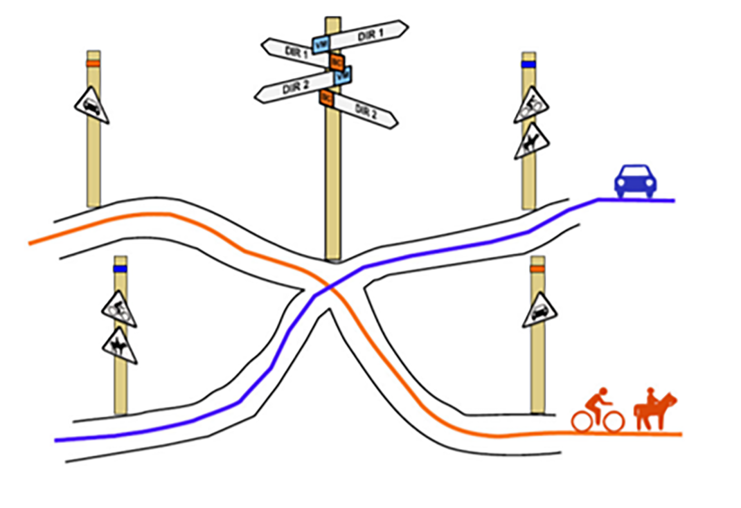 |
Intersection between a trail for bicycles and horses and a trail for motor vehiclesAs you can see in the image, the signage warns cyclists, riders and vehicles that an intersection is approaching. Right of way in this case is as follows:
|
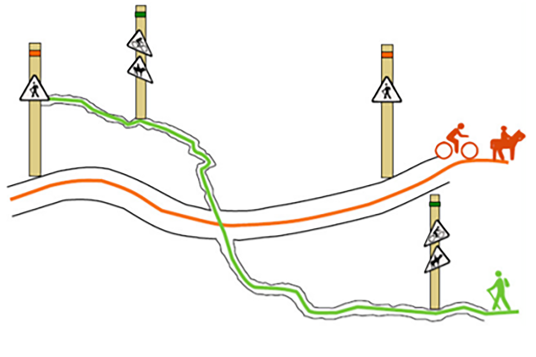 |
Intersection between a trail for bicycles and horses with a local trailAs in the previous examples, the signage warns cyclists, riders and walkers that an intersection is approaching. Remember that along all trails, users travelling on foot always have right of way. |


