ePrivacy and GPDR Cookie Consent management by TermsFeed Privacy Policy and Consent Generator BC-1.2 Las Calderetas

BC-1.2 Las Calderetas

BC-1.2

Ravelo, extension of route BC 1 to the Las Calderetas Recreational Area.

Incident Incident

Route temporarily closed - Warnings (fire, wind, etc.)

Itinerario cerrado debido al incendio forestal del verano de 2023

Las Calderetas
Las Calderetas

Description

This route is your gateway to a landscape that is undergoing a process of transformation as it is restored to its original state.

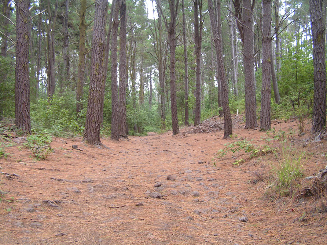
The section that connects the Las Calderetas Recreational Area with the Great North Route (BC 1) passes along a section of an ancient camino real (“royal road” or main island route), as can be seen by the remains of cobblestones between pine trees and monteverde reclaiming their territory. 

In some places you will be fortunate to see some example of hija (Prunus lusitanica), a plant species which is abundant in the Anaga Massif but difficult to spot in other areas of the island. And if you are patient and quiet, it is an ideal location for spotting birds such as the Eurasian sparrowhawk, the Eurasian woodcock, and Bolle’s pigeon.

IBP Index: 2.

Tips

  • Always stay on the marked trail and do not enter private property, hunting grounds, water galleries, wells or caves.  
  • Be careful when walking along roads used by motor vehicles and hiking trails, and when crossing ravines with water courses.
  • Avoid direct encounters with potentially dangerous animals, such as livestock, beehives, and dogs. 
  • Proceed with caution and watch for obstacles, loose rocks, uneven terrain or steep slopes to avoid accidents and falls. 
  • Consult our good practice guide and, if necessary, contact emergency services by calling 112.
Recommendations and tips

Guides

No data available

Permits

  • Reservation obligatory for groups organised by for-profit and not-for-profit public and private entities and profit-making individuals. Link
  • T: 901 501 901 - 922 239 500.
  • Free access for all other users, alone or in a group, no reservation required.

Technical information sheet

Route information

Cycling and horse riding route

Tenerife ON

Linear

1,01 km

0 h 5 m

9,15 m

43,28 m

At an average speed of 14 km/h

  • Altitude gain:9,15 m

  • Altitude loss:43,28 m

  • Maximum altitude:986,60 m

  • Minimum altitude:950,55 m

Signage

Route code

BC-1.2

Orange posts and signs that include:

  • Official trail number.
  • Route direction.
  • Distance to points of interest.
  • Cyclist and horserider icons.
Signage

Route map and profile

Elevation profile

  • Maximum altitude:986,60 m

  • Minimum altitude:950,55 m

Connections with other routes

  • /

How to get to route start point

Route BC 1, Las Aguilillas Trail, El Sauzal.

No nearby service.

No parking area nearby.

How to get to route end point

Las Calderetas Recreational Area, calle Lomo Las Piedras, intersection with the Las Calderetas trail, El Ravelo, El Sauzal.

No nearby service.

Parking spaces in the Las Calderetas Recreational Area.

Municipalities passed through

  • El Sauzal

Protected Areas

Transit

Paisaje Protegido de Las Lagunetas

The Las Lagunetas Protected Landscape is situated on the north side of the Pedro Gil ridge, in the north-east of Tenerife.  This ridge was formed over the course of numerous phases of eruption less ...

Discover the Protected Area
Paisaje Protegido de Las Lagunetas

Weather

Today, thursday, in El Sauzal


Clouds
Wind

6 km/h

Temperature

21ºC Maximum

19ºC Minimum

Rain

0%

3 day forecast

friday

20ºC Maximum

18ºC Minimum

saturday

19ºC Maximum

17ºC Minimum

sunday

19ºC Maximum

18ºC Minimum