ePrivacy and GPDR Cookie Consent management by TermsFeed Privacy Policy and Consent Generator PNT 13.1 Ramal Alto de Sámara

PNT 13.1 Ramal Alto de Sámara

PNT-13.1

Teide National Park

Ramal Sámara

Difficulty: Medium

Description

A short 360-metre branch at the start of the PNT 13 (Sámara) trail that takes you up to the summit of the Sámara volcano.

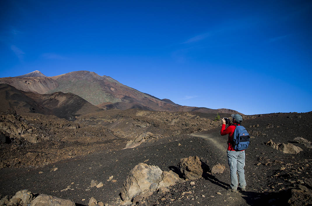
From there you will be rewarded with sweeping, spectacular panoramic views of several volcanic cones, as well as Mount Teide and Pico Viejo.

Tips

  • Always stay on the marked trail and do not enter private property, hunting grounds, water galleries, wells or caves. 
  • Pay special attention when crossing or walking along trails used by bicycles, horses or motor vehicles and when walking in ravines with water courses.
  • Avoid direct encounters with potentially dangerous animals, such as livestock, beehives, and dogs. 
  • Proceed with caution and watch for obstacles, loose rocks, uneven terrain or steep slopes to avoid accidents and falls.
  • Check out our guide to hiking in Tenerife and, if necessary, contact the emergency services by calling 112.


Recommendations and tips

Permits

Free access for all visitors, no reservation required.

More information

Technical information sheet

Route information

Walking route

Tenerife ON

Linear

0,26 km

0 h 20 m

44,01 m

7,20 m

One way with fitness level 3/5

  • Altitude gain:44,01 m

  • Altitude loss:7,20 m

  • Maximum altitude:1.935,57 m

  • Minimum altitude:1.898,21 m

Signage

Route code

PNT-13.1

Signposts and waymarkers with the code of the trail on dark green panels.

Signage

Route map and profile

Elevation profile

Difficulty

Medium *MIDE safe mountain criteria

  • Maximum altitude:1.935,57 m

  • Minimum altitude:1.898,21 m

Connections with other routes

How to get to route start point

Sámara Viewpoint, Carretera Boca Tauce (TF-38), km 7.5.

No nearby service.

Limited parking spaces at the viewpoint.

How to get to route end point

Montaña Sámara.

End point only accessible on foot from the PNT 13 trail (Sámara).

End point only accessible on foot from the PNT 13 trail (Sámara).

Municipalities passed through

  • Guía de Isora

Protected Areas

Transit

Parque Nacional del Teide

The Teide National Park is the best exampleof the high-mountain landscape of the Canary Islands.  It is a breathtaking setting where you can learn about some of the most spectacular volcanic ...

Discover the Protected Area
Parque Nacional del Teide

Transit

Parque Natural de la Corona Forestal

The Corona Forestal is the largest protected natural area in the Canary Islands, one of the most extensive forests on the islands, the lungs of Tenerife and the gateway to Mount Teide.  As its name ...

Discover the Protected Area
Parque Natural de Corona Forestal

Weather

Today, monday, in Guía de Isora


Clouds
Wind

1 km/h

Temperature

16ºC Maximum

10ºC Minimum

Rain

0%

3 day forecast

tuesday

17ºC Maximum

11ºC Minimum

wednesday

18ºC Maximum

13ºC Minimum

thursday

19ºC Maximum

13ºC Minimum

Places of interest

These are some of the points of interest you can find along this route.

Rock

Montaña de Sámara

Montaña de Samara is a striking volcanic cone that marks the entrance to the National Park. Its...