ePrivacy and GPDR Cookie Consent management by TermsFeed Privacy Policy and Consent Generator PNT 03 Roques de García

PNT 03 Roques de García

PNT-03

Teide National Park

Roques de García
Roques de García
Roques de García
Roques de García
Roques de García

Difficulty: Low

Description

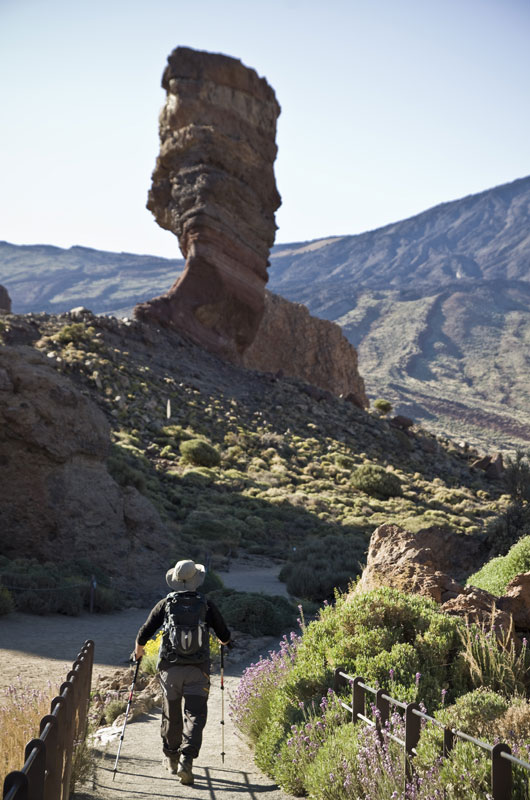
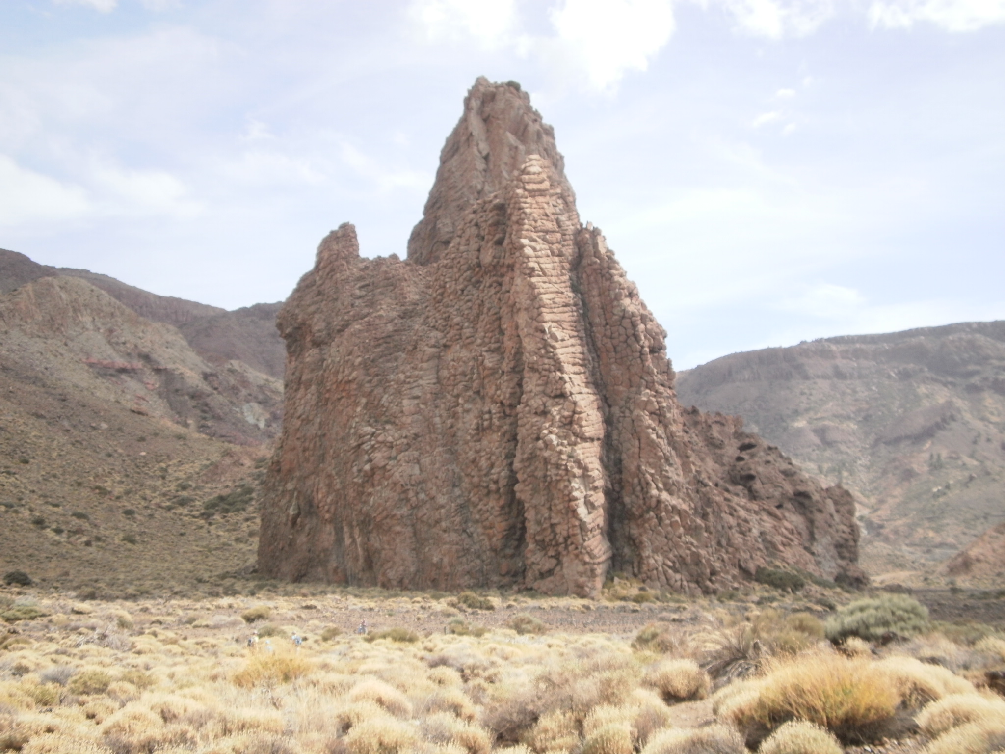
One of the most popular trails in the National Park due to its low difficulty and the great beauty of its landscapes, with Mount Teide stealing the show.

The route takes you around the Roques de García, the most striking of which are Cinchado and Torrotito. 

The start of the route takes you along the accessible Roques de García trail. Then follow a flat path, leaving the famous rock formations to your left, to the plain known as Llano de Ucanca. 

At this point a slight descent begins and you will enjoy beautiful views of La Cascada, a lava flow formed by highly fluid magma. You will then border the landform known as La Catedral and return to the trailhead.

Tips

  • Always stay on the marked trail and do not enter private property, hunting grounds, water galleries, wells or caves.  
  • Pay special attention when crossing or walking along trails used by bicycles, horses or motor vehicles and when walking in ravines with water courses.
  • Avoid direct encounters with potentially dangerous animals, such as livestock, beehives, and dogs. 
  • Proceed with caution and watch for obstacles, loose rocks, uneven terrain or steep slopes to avoid accidents and falls.
  • Check out our guide to hiking in Tenerife and, if necessary, contact the emergency services by calling 112.


Recommendations and tips

Permits

Free access for all visitors, no reservation required.

More information

Technical information sheet

Route information

Walking route

Tenerife ON

Circular

3,47 km

1 h 55 m

202,19 m

202,19 m

One way with fitness level 3/5

  • Altitude gain:202,19 m

  • Altitude loss:202,19 m

  • Maximum altitude:2.183,54 m

  • Minimum altitude:2.022,55 m

Signage

Route code

PNT-03

Signposts and waymarkers with the code of the trail on dark green panels.

Signage

Route map and profile

Elevation profile

Difficulty

Low *MIDE safe mountain criteria

  • Maximum altitude:2.183,54 m

  • Minimum altitude:2.022,55 m

Connections with other routes

How to get to route start point

La Ruleta Viewpoint, Carretera General del Teide (TF-21), km 46.

bus numbers 348 and 342, Parador del Teide bus stop code 7684. TITSA

Parking spaces are available, with reserved areas for people with reduced mobility.

How to get to route end point

La Ruleta Viewpoint, Carretera General del Teide (TF-21), km 46.

Bus numbers 348 and 342, Parador del Teide bus stop code 7684. TITSA

Parking spaces are available, with reserved areas for people with reduced mobility.

Municipalities passed through

  • La Orotava

Protected Areas

Transit

Parque Nacional del Teide

The Teide National Park is the best exampleof the high-mountain landscape of the Canary Islands.  It is a breathtaking setting where you can learn about some of the most spectacular volcanic ...

Discover the Protected Area
Parque Nacional del Teide

Weather

Today, friday, in La Orotava


Clouds
Wind

3 km/h

Temperature

19ºC Maximum

16ºC Minimum

Rain

0%

3 day forecast

saturday

18ºC Maximum

15ºC Minimum

sunday

18ºC Maximum

15ºC Minimum

monday

19ºC Maximum

14ºC Minimum

Places of interest

These are some of the points of interest you can find along this route.

Catedral_Teide
Rock

La Catedral (The Cathedral)

Volcanic plug that resembles a great cathedral.

...
Roques_Garcia
Rock

Roques de García

The most famous rock formation in Tenerife, with curious shapes that earned their place in...