ePrivacy and GPDR Cookie Consent management by TermsFeed Privacy Policy and Consent Generator BC-1.8 Ramón Caminero via La Bermeja

BC-1.8 Ramón Caminero via La Bermeja

BC-1.8

Pinar de La Orotava, extension of route BC1 which connects the Chanajiga and El Caminero Recreational Areas.

Incident Incident

Route temporarily closed - Recreational activities

Cierre parcial de la pista por conservación de pista forestal

Route temporarily closed - Works

Cierre parcial de la pista por conservación de pista forestal

Route temporarily closed - Works

Cierre parcial de la pista por conservación de pista forestal

Route partially closed - Warnings (fire, wind, etc.)

Itinerario cerrado debido al incendio forestal del verano de 2023. Abierta desde el cruce de la Pista La Bermeja hasta el cruce con la Carretera TF 21.

Route temporarily closed - Warnings (fire, wind, etc.)

Itinerario cerrado debido al incendio forestal del verano de 2023. Abierta desde el cruce de la Pista La Bermeja hasta el cruce con la Carretera TF 21.

Ramón Caminero via La Bermeja

Description

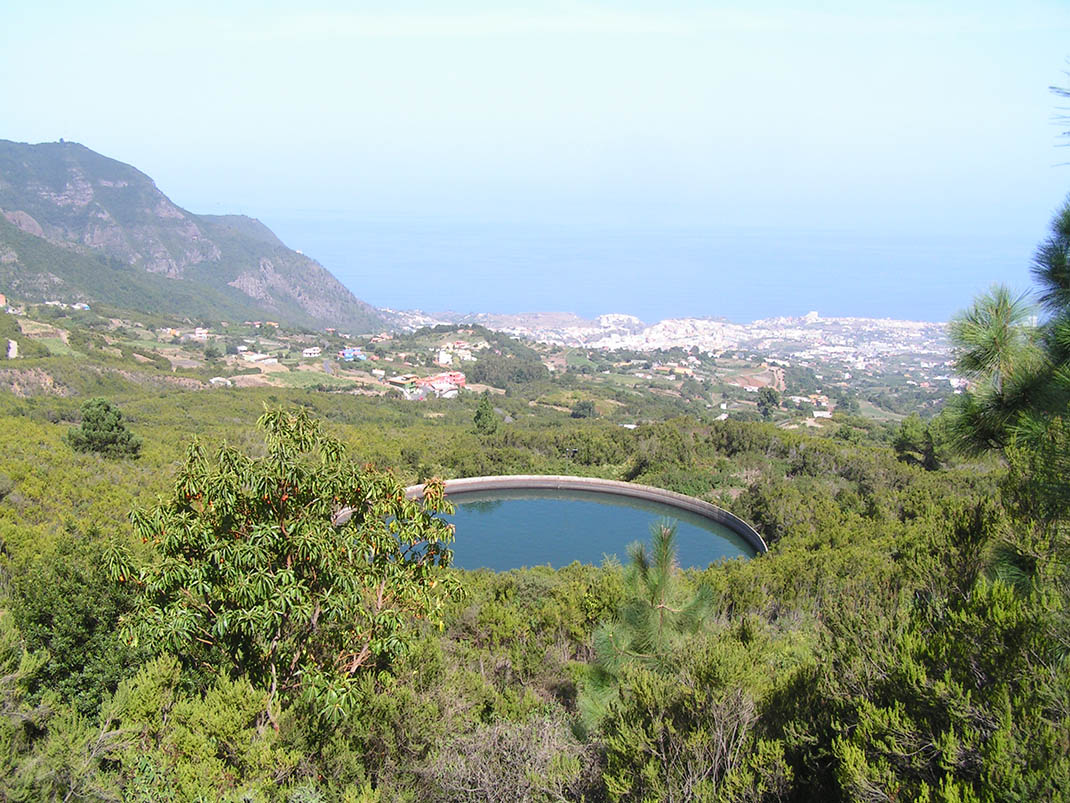
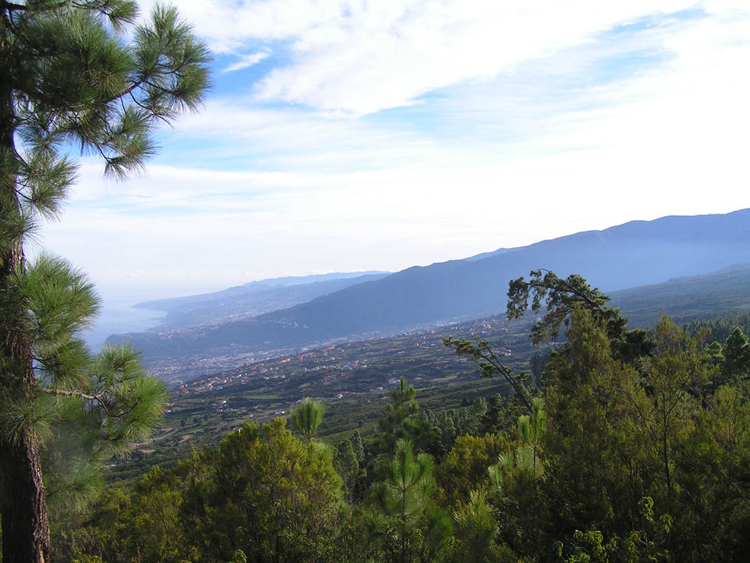
The spectacular landscape and vegetation along this route give you an idea of how lush the north of Tenerife was in the past. 

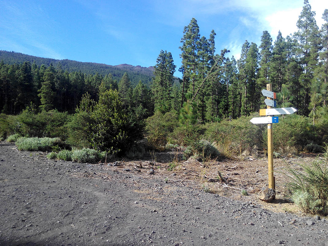
The route passes along the Nueva and Bermeja trails, crossing the Corona Forestal Natural Park, framed by the summits of the Teide National Park, the Tigaiga mountain slopes, the north coast and the slopes of La Resbala. You will discover some geological treasures along the route, such as deep ravines and striking lava flows. If you pay attention, you will be able to spot the changes in colour in the strata of the terrain to the sides of the trail. 

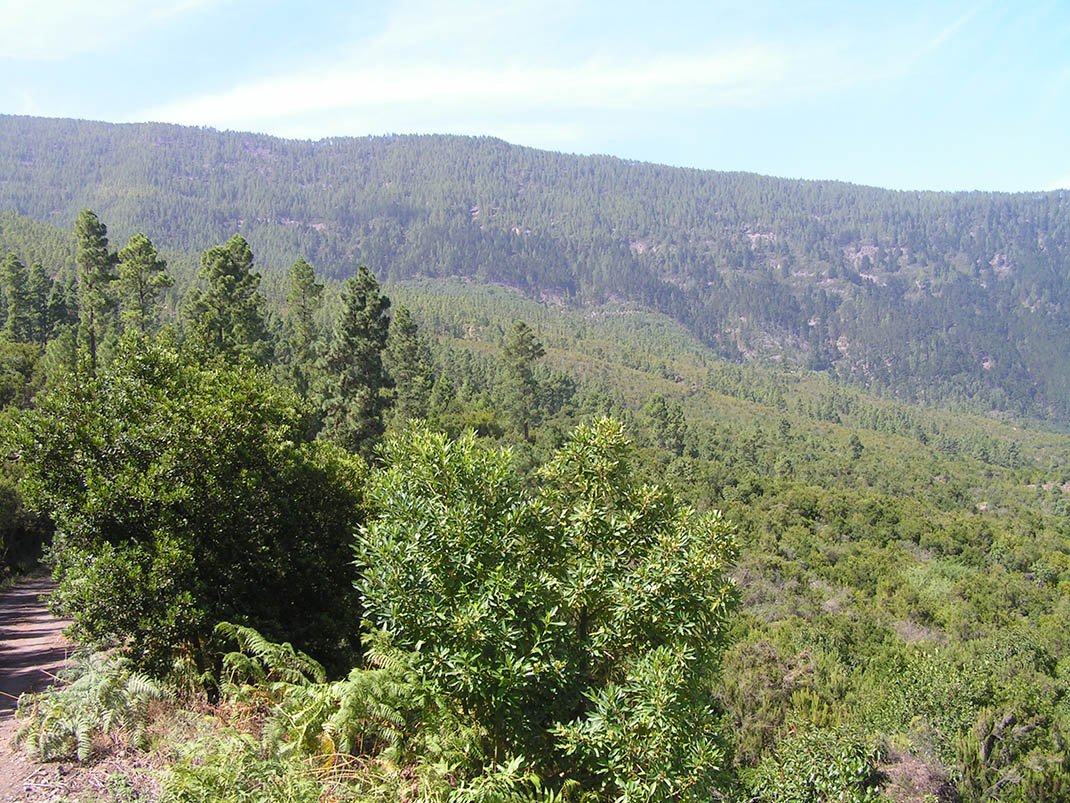
As you descend you will pass through a variety of different plant formations, beginning with a Canary Island pine forest, along with broom bushes, the Teide alelí (Erysimum scoparium), and the rosalillo de cumbre (Pterocephalus lasiospermus). You will notice that forestry services have opened up some clearings to reduce competition among the trees. 

The trail continues through a mixed pine forest (Monterey and Canary), with a wide variety of species that are particularly beautiful in spring and autumn, during the flowering and fruit-bearing periods.

IBP Index: 31.

Tips

  • Always stay on the marked trail and do not enter private property, hunting grounds, water galleries, wells or caves.  
  • Be careful when walking along roads used by motor vehicles and hiking trails, and when crossing ravines with water courses.
  • Avoid direct encounters with potentially dangerous animals, such as livestock, beehives, and dogs. 
  • Proceed with caution and watch for obstacles, loose rocks, uneven terrain or steep slopes to avoid accidents and falls. 
  • Consult our good practice guide and, if necessary, contact emergency services by calling 112.
Recommendations and tips

Guides

No data available

Permits

  • Reservation obligatory for groups organised by for-profit and not-for-profit public and private entities and profit-making individuals. Link
  • T: 901 501 901 - 922 239 500.
  • Free access for all other users, alone or in a group, no reservation required.

Technical information sheet

Route information

Cycling and horse riding route

Tenerife ON

Linear

8,87 km

0 h 40 m

563,95 m

165,51 m

At an average speed of 14 km/h

  • Altitude gain:563,95 m

  • Altitude loss:165,51 m

  • Maximum altitude:1.589,60 m

  • Minimum altitude:1.185,70 m

Signage

Route code

BC-1.8

Orange posts and signs that include:

  • Official trail number.
  • Route direction.
  • Distance to points of interest.
  • Cyclist and horserider icons. 
Signage

Route map and profile

Elevation profile

  • Maximum altitude:1.589,60 m

  • Minimum altitude:1.185,70 m

Connections with other routes

  • /

How to get to route start point

Route BC 1, Benijos trail, Los Realejos.

No nearby service.

No parking spaces in the area.

How to get to route end point

Ramón Caminero Recreational Area, Carretera de Las Cañadas del Teide (TF-21), km 24.3, La Orotava.

Bus number 348, Casa del Caminero bus stop code 4939. TITSA

Parking spaces available in the Ramón Caminero Recreational Area.

Municipalities passed through

  • La Orotava
  • Los Realejos

Protected Areas

Transit

Parque Natural de la Corona Forestal

The Corona Forestal is the largest protected natural area in the Canary Islands, one of the most extensive forests on the islands, the lungs of Tenerife and the gateway to Mount Teide.  As its name ...

Discover the Protected Area
Parque Natural de Corona Forestal

Weather

Today, thursday, in Los Realejos


Clouds
Wind

6 km/h

Temperature

20ºC Maximum

15ºC Minimum

Rain

0%

3 day forecast

friday

17ºC Maximum

14ºC Minimum

saturday

20ºC Maximum

14ºC Minimum

sunday

21ºC Maximum

16ºC Minimum