ePrivacy and GPDR Cookie Consent management by TermsFeed Privacy Policy and Consent Generator Trail connecting PR TF 25.2 with PR TF 25.3

Trail connecting PR TF 25.2 with PR TF 25.3

Las Lagunetas

Incident Incident

Route temporarily closed - Warnings (fire, wind, etc.)

Itinerario cerrado debido al incendio forestal del verano de 2023

Enlace PR-TF 25.2 con PR-TF 25.3
Enlace PR TF 25.2 y 3

Difficulty: Low

Description

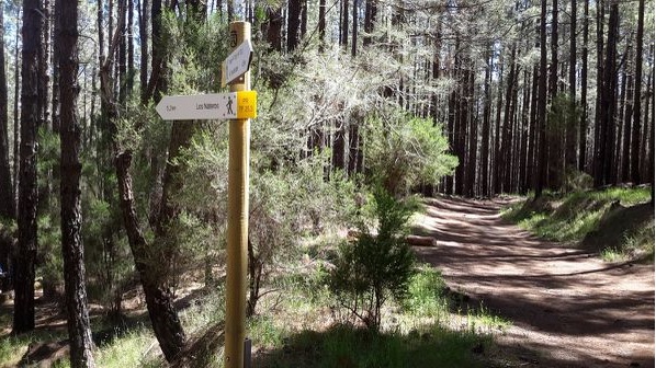
A short 700 m trail that runs along the first section of route 2 of the Camino de Candelaria, a pilgrimage route to the Basilica of Candelaria. 

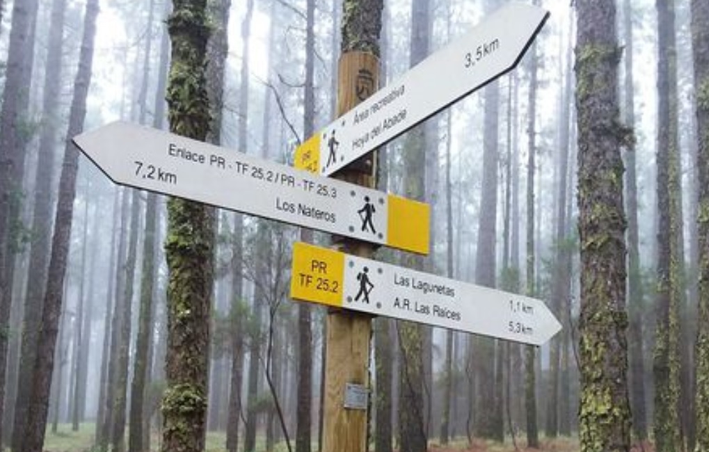
This is a slightly descending track through dense Canary Island pine forest that joins the PR TF 25.2 (Las Lagunetas - Hoya de Abade) with the PR TF 25.3 (Las Lagunetas - Los Nateros).

Tips

  • Always stay on the marked trail and do not enter private property, hunting grounds, water galleries, wells or caves. 
  • Pay special attention when crossing or walking along trails used by bicycles, horses or motor vehicles and when walking in ravines with water courses.
  • Avoid direct encounters with potentially dangerous animals, such as livestock, beehives, and dogs.
  • Proceed with caution and watch for obstacles, loose rocks, uneven terrain or steep slopes to avoid accidents and falls.
  • Check out our guide to hiking in Tenerife and, if necessary, contact the emergency services by calling 112.


Recommendations and tips

Guides

No data available

Permits

  • [TEMPORARY MEASURE] Free access without authorisation or reservation for natural or legal entities of a public or private nature, both non-profit (town councils, schools, associations, clubs, etc.) and for-profit (active tourism companies), until 31 December 2024 as established in the Resolution.
  • Free access for all other visitors, no reservation required.
  • Email for enquiries - This email address is being protected from spambots. You need JavaScript enabled to view it.
More information

Technical information sheet

Route information

Walking route

Tenerife ON

Linear

0,71 km

0 h 20 m

4,91 m

82,54 m

One way with fitness level 3/5

  • Altitude gain:4,91 m

  • Altitude loss:82,54 m

  • Maximum altitude:1.463,95 m

  • Minimum altitude:1.386,33 m

Signage

Posts and signs displaying the PR code and yellow and white marks.

Signage

Route map and profile

Elevation profile

Difficulty

Low *MIDE safe mountain criteria

  • Maximum altitude:1.463,95 m

  • Minimum altitude:1.386,33 m

Connections with other routes

How to get to route start point

Las Lagunetas

Midpoint of the PR TF 25.2 trail, only accessible on foot from the Carretera General de La Esperanza (TF-24), km 16.5, Las Lagunetas.

Midpoint of the PR TF 25.2 trail, only accessible on foot from the Carretera General de La Esperanza (TF-24), km 16.5, Las Lagunetas.

How to get to route end point

Las Lagunetas

Midpoint of the PR TF 25.3 trail, only accessible on foot from the Carretera General de La Esperanza (TF-24), km 16.5, Las Lagunetas.

Midpoint of the PR TF 25.3 trail, only accessible on foot from the Carretera General de La Esperanza (TF-24), km 16.5, Las Lagunetas.

Municipalities passed through

  • La Matanza de Acentejo
  • La Victoria de Acentejo

Protected Areas

Transit

Paisaje Protegido de Las Lagunetas

The Las Lagunetas Protected Landscape is situated on the north side of the Pedro Gil ridge, in the north-east of Tenerife.  This ridge was formed over the course of numerous phases of eruption less ...

Discover the Protected Area
Paisaje Protegido de Las Lagunetas

Weather

Today, monday, in La Victoria de Acentejo


Clouds
Wind

6 km/h

Temperature

18ºC Maximum

14ºC Minimum

Rain

0%

3 day forecast

tuesday

19ºC Maximum

15ºC Minimum

wednesday

20ºC Maximum

16ºC Minimum

thursday

20ºC Maximum

16ºC Minimum