ePrivacy and GPDR Cookie Consent management by TermsFeed Privacy Policy and Consent Generator BC-5 Pinares de Vilaflor

BC-5 Pinares de Vilaflor

BC-5

Southern side of the island, through the Vilaflor pine forest

Pinares de Vilaflor
Pinares de Vilaflor
Pinares de Vilaflor
Pinares de Vilaflor

Description

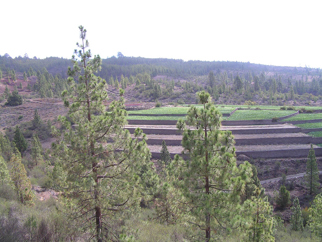
This route takes you through a landscape full of contrasts: the white volcanic gravel covering agricultural plots, the black and ochre of the trail and the green pine trees. 

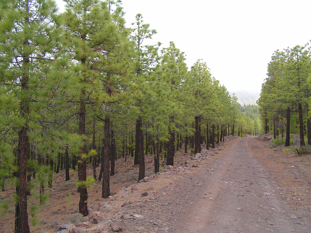
At the start of the route you will be able to see the traces of the important farming activity that still persists in part of this area today. As you continue, the agricultural landscape with terraces covered in volcanic gravel for growing cereals gives way to the forest ecosystem as you enter the Corona Forestal Natural Park, where the pine tree takes over. 

Along the route you will come across giant pine trees known as “pinos padre”, survivors from the time when exploitation of timber and resin almost decimated the pine forests on the island. In the undergrowth you will see escobones (Chamaecytisus proliferus), codesos (Adenocarpus viscosus), jaras (Cistus symphytifolius) and striking flowering species such as tajinaste rojo (Echium wildpretii) and tajinaste picante (Echium auberianum). 

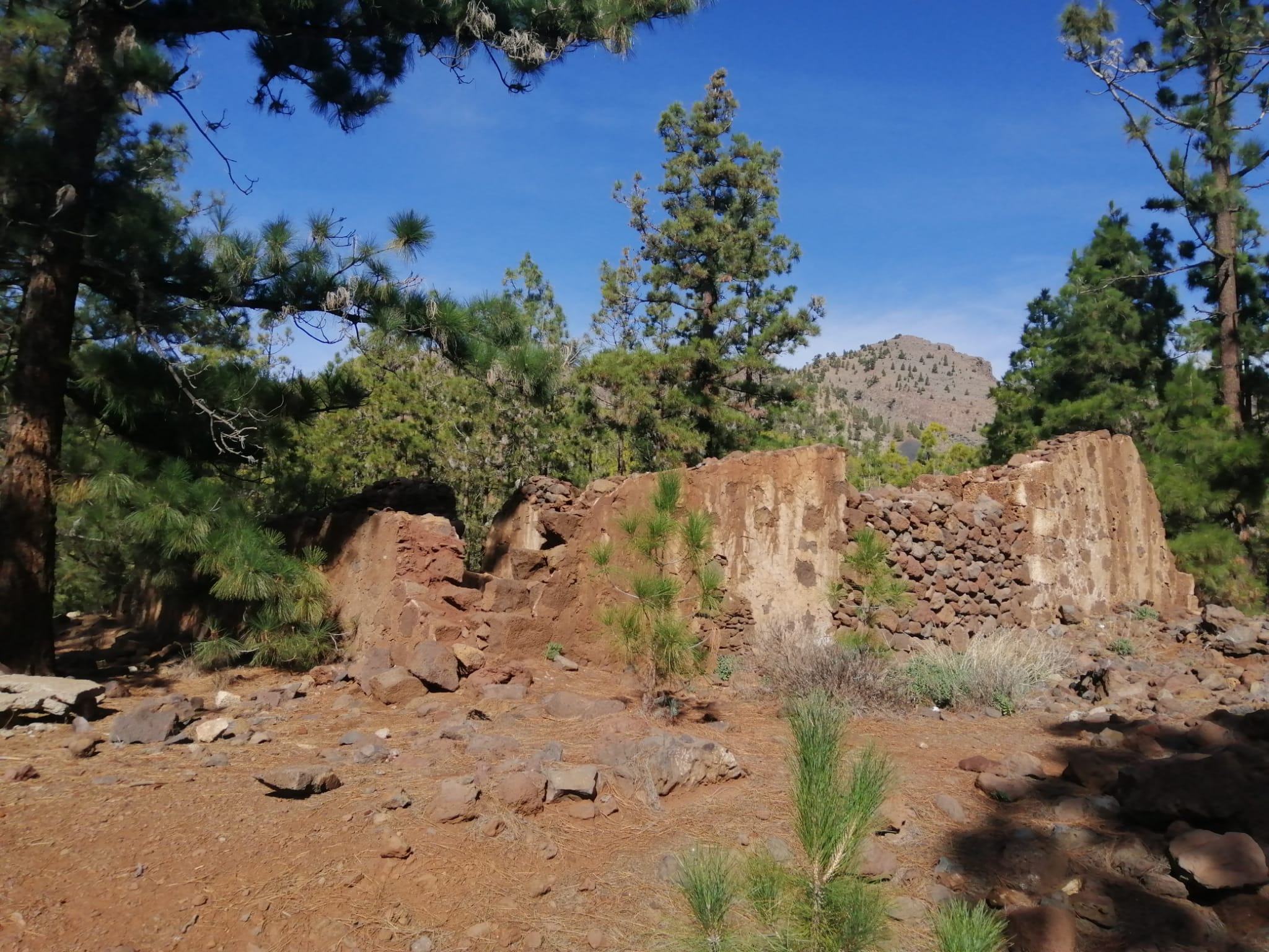
The most impressive ravines along the route include Los Eris, Fuente Agria and Pinalito, where until just a few years ago there used to exist a site for bottling water. 

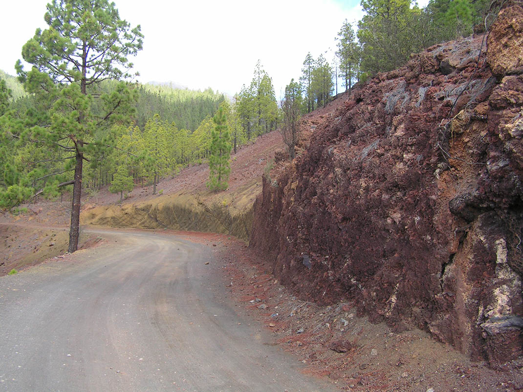
Finally, the unique view of “Los Riscos”, an impressive wall of red, will add the finishing touch to this route.

IBP Index: 16.

Tips

  • Always stay on the marked trail and do not enter private property, hunting grounds, water galleries, wells or caves.  
  • Be careful when walking along roads used by motor vehicles and hiking trails, and when crossing ravines with water courses.
  • Avoid direct encounters with potentially dangerous animals, such as livestock, beehives, and dogs. 
  • Proceed with caution and watch for obstacles, loose rocks, uneven terrain or steep slopes to avoid accidents and falls. 
  • Consult our good practice guide and, if necessary, contact emergency services by calling 112.
Recommendations and tips

Guides

No data available

Permits

  • Reservation obligatory for groups organised by for-profit and not-for-profit public and private entities and profit-making individuals. Link
  • T: 901 501 901, 922 239 500.
  • Free access for all other users, alone or in a group, no reservation required.

Technical information sheet

Route information

Cycling and horse riding route

Tenerife ON

Linear

13,79 km

1 h 0 m

593,83 m

749,61 m

At an average speed of 14 km/h

  • Altitude gain:593,83 m

  • Altitude loss:749,61 m

  • Maximum altitude:1.940,76 m

  • Minimum altitude:1.585,92 m

Signage

Route code

BC-5

Orange posts and signs that include:

  • Official trail number.
  • Route direction.
  • Distance to points of interest.
  • Cyclist and horserider icons.
Signage

Route map and profile

Elevation profile

  • Maximum altitude:1.940,76 m

  • Minimum altitude:1.585,92 m

Connections with other routes

How to get to route start point

Agua Agria trail, Carretera General de Vilaflor (TF-21) km 64, Vilaflor.

No nearby service.

No parking spaces in the area.

How to get to route end point

Madre del Agua trail, Carretera General de Vilaflor (TF-21) km 66, Vilaflor.

No nearby service.

No parking spaces in the area.

Municipalities passed through

  • Granadilla de Abona
  • Vilaflor

Protected Areas

Transit

Parque Natural de la Corona Forestal

The Corona Forestal is the largest protected natural area in the Canary Islands, one of the most extensive forests on the islands, the lungs of Tenerife and the gateway to Mount Teide.  As its name ...

Discover the Protected Area
Parque Natural de Corona Forestal

Weather

Today, thursday, in Vilaflor


Clouds
Wind

1 km/h

Temperature

19ºC Maximum

12ºC Minimum

Rain

0%

3 day forecast

friday

17ºC Maximum

11ºC Minimum

saturday

15ºC Maximum

10ºC Minimum

sunday

14ºC Maximum

9ºC Minimum

Places of interest

These are some of the points of interest you can find along this route.

Casa Marrubial
Unique building

Casas Marrubial

Ruins of a stone building where the local livestock farmers used to live.

...