ePrivacy and GPDR Cookie Consent management by TermsFeed Privacy Policy and Consent Generator PR TF 10 Cruz del Carmen - Punta del Hidalgo

PR TF 10 Cruz del Carmen - Punta del Hidalgo

PR-TF 10

Macizo de Anaga

Cruz del Carmen - Punta del Hidalgo

Difficulty: Medium

Description

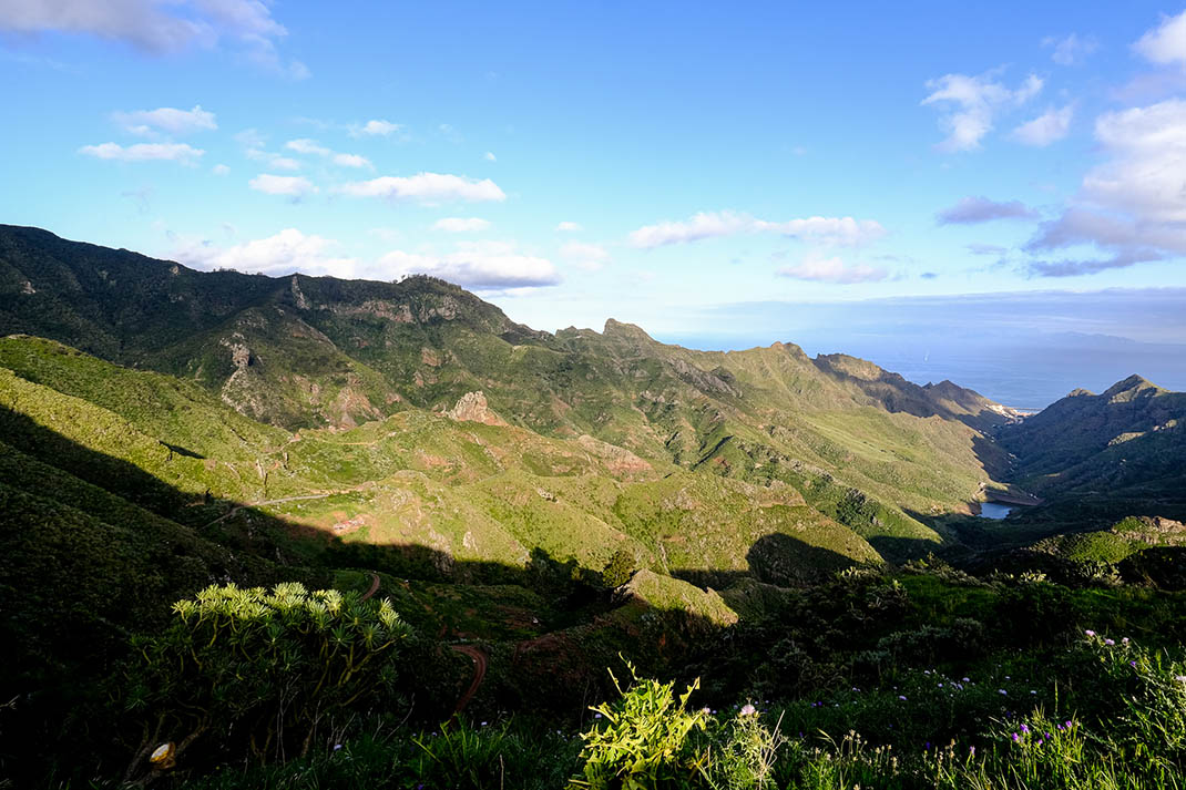
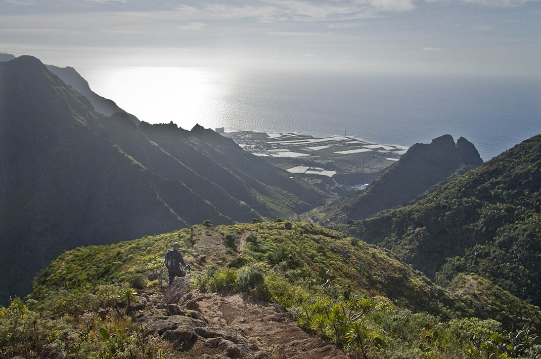
This trail runs from the summit to the coast and descends through all the layers of vegetation in the Anaga Rural Park. 

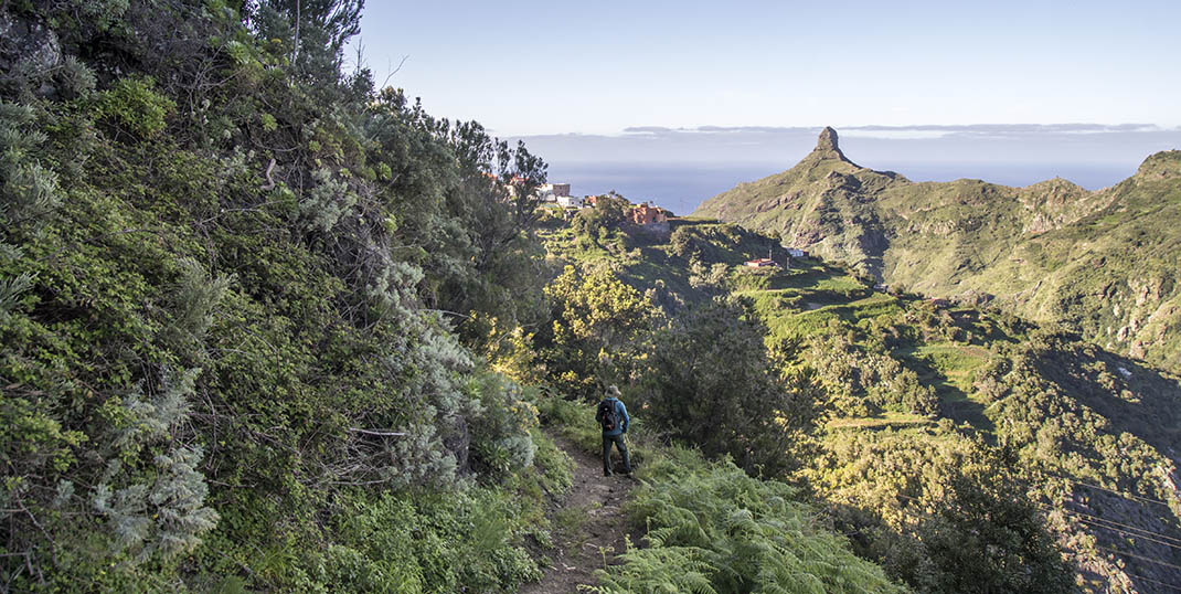
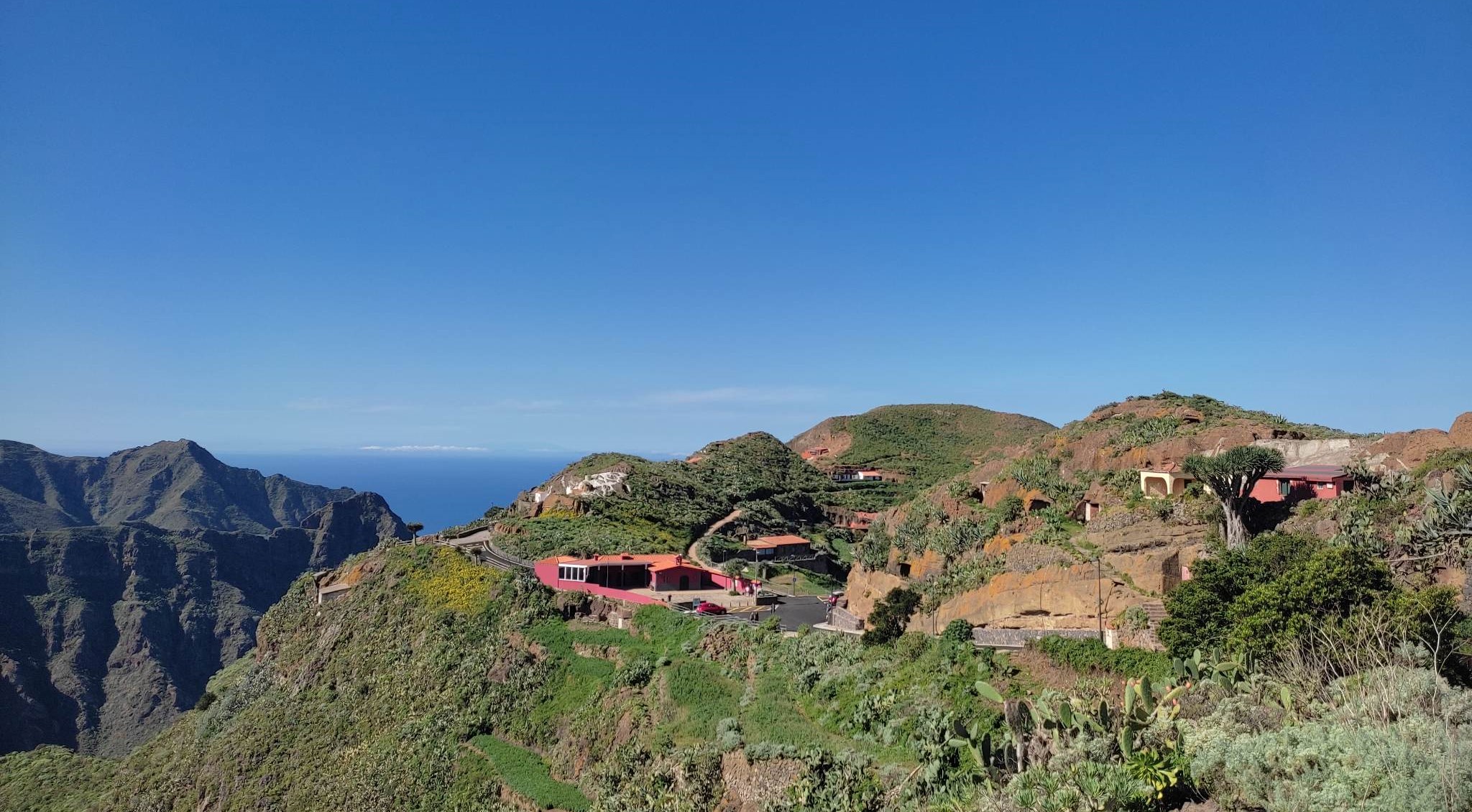
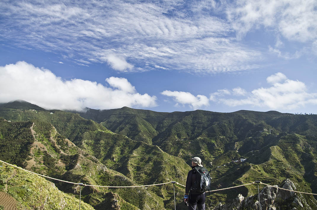
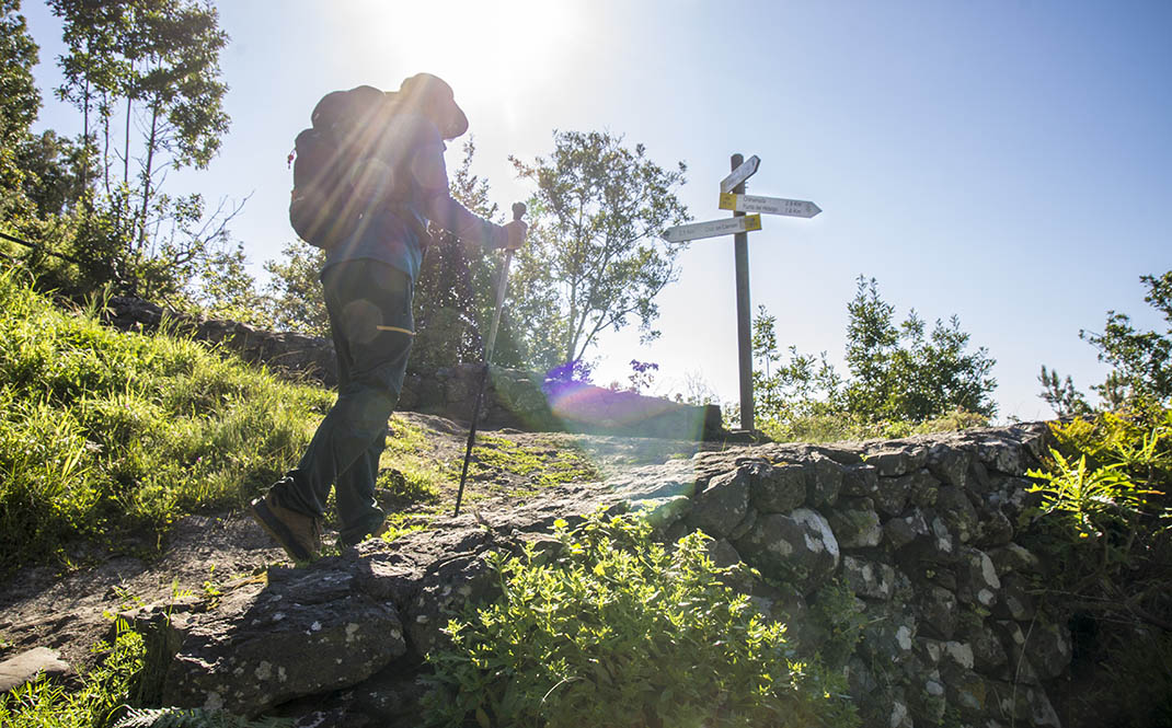
It starts at the Cruz del Carmen Visitor Centre and leads northwards through the laurel forest to Chinamada. Once there, you will be able to admire the famous cave houses of the area. 

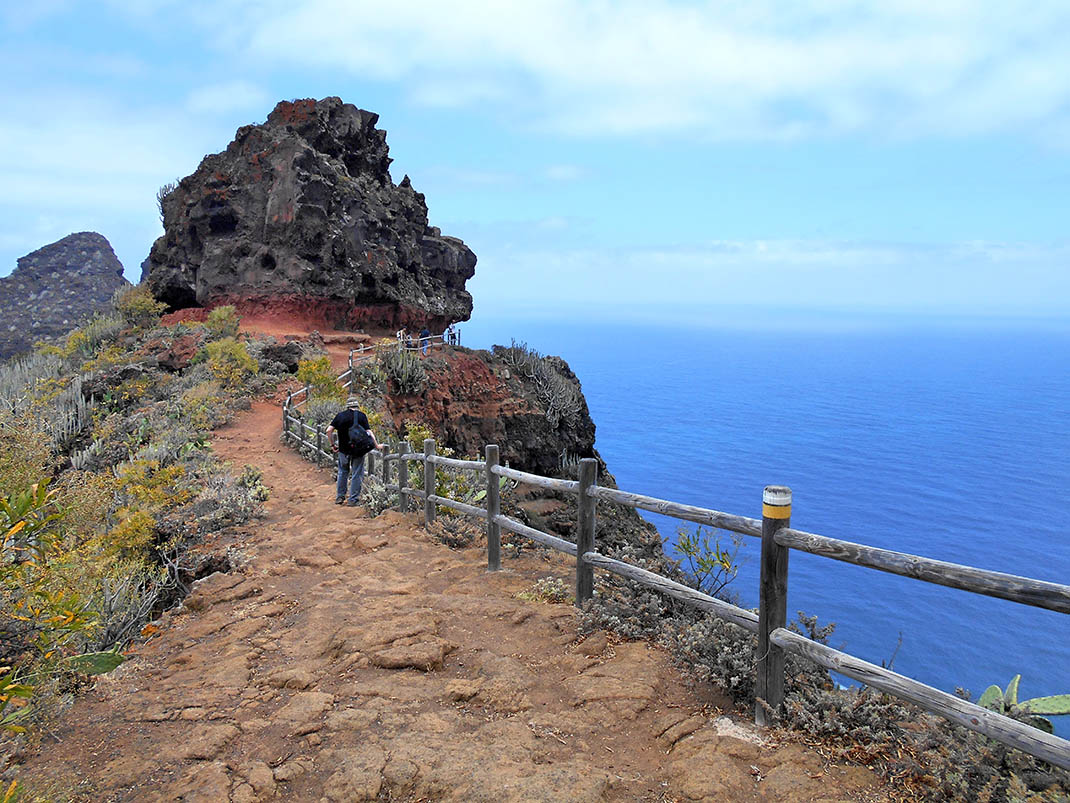
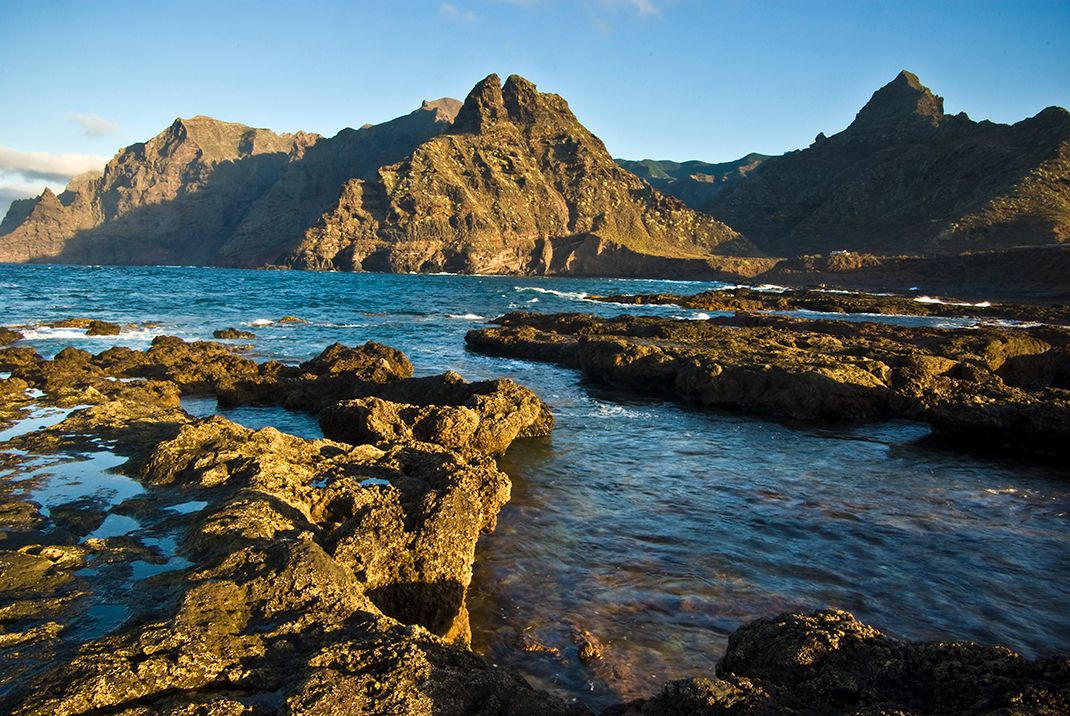
From this point, the route continues towards Punta del Hidalgo along a path carved in the rock with magnificent views of the north coast of the Anaga Massif. This last section has a steep descent, so we recommend that you take particular care.

Tips

  • Always stay on the marked trail and do not enter private property, hunting grounds, water galleries, wells or caves. 
  • Pay special attention when crossing or walking along trails used by bicycles, horses or motor vehicles and when walking in ravines with water courses.
  • Avoid direct encounters with potentially dangerous animals, such as livestock, beehives, and dogs. 
  • Proceed with caution and watch for obstacles, loose rocks, uneven terrain or steep slopes to avoid accidents and falls.
  • Check out our guide to hiking in Tenerife and, if necessary, contact the emergency services by calling 112.


Recommendations and tips

Guides

Self Guided Route Cruz del Carmen - Punta del Hidalgo (via Chinamada)

Anaga Biosphere Reserve website

Permits

Free access for all visitors, no reservation required.

More information

Technical information sheet

Route information

Walking route

Tenerife ON

Linear

9,88 km

5 h 10 m

624,58 m

1.503,27 m

One way with fitness level 3/5

  • Altitude gain:624,58 m

  • Altitude loss:1.503,27 m

  • Maximum altitude:949,99 m

  • Minimum altitude:5,06 m

Signage

Route code

PR-TF 10

Posts and signs displaying the PR code and yellow and white marks.

Signage

Route map and profile

Elevation profile

Difficulty

Medium *MIDE safe mountain criteria

  • Maximum altitude:949,99 m

  • Minimum altitude:5,06 m

Connections with other routes

How to get to route start point

Cruz del Carmen Viewpoint, Carretera Las Mercedes (TF-12), km 22.5.

Bus numbers 76, 77, 273, and 275, Cruz del Carmen bus stop code 2232. TITSA

Parking spaces available near the viewpoint.

How to get to route end point

Carretera General Punta del Hidalgo (TF-13), end of the road.

Bus numbers 50, 105 and 224, Punta del Hidalgo bus stop code 1327. TITSA

Limited parking spaces available in the town.

Municipalities passed through

  • La Laguna

Protected Areas

Transit

Parque Rural de Anaga

The Anaga Rural Park, which occupies 7% of the island and is part of the Anaga Biosphere Reserve, was one of the first landmasses to emerge from the seabed when the island of Tenerife began to ...

Discover the Protected Area
Parque Rural de Anaga

Weather

Today, tuesday, in San Cristóbal de la Laguna


Clear skies
Wind

1 km/h

Temperature

29ºC Maximum

25ºC Minimum

Rain

0%

3 day forecast

wednesday

27ºC Maximum

24ºC Minimum

thursday

25ºC Maximum

21ºC Minimum

friday

22ºC Maximum

19ºC Minimum

Places of interest

These are some of the points of interest you can find along this route.

Ravine

Barranco del Tomadero

Barranco del Tomadero is a deep ravine originating at Risco de los dos Hermanos. This impressive...

Unique building

“El Puntero” in memory of Sebastián Ramos

Tribute to Sebastián Ramos “El Puntero” (1894-1976) one of the most important folk singers...

Oficina_Turismo_Punta_del_Hidalgo
Tourist Information Point

Punta del Hidalgo Information Office.- The Tenerife Sea and Fishing Interpretation Centre.

922157832 oit.ptahidalgo@turismolalaguna.org
Rock

Cabezo de Tenejía

Cabezo de Tenejía is an impressive rocky outcrop near Las Carboneras and is a prominent landmark...

Playa de Troche
Beach

Troche Beach

This is a pristine and secluded pebble beach. The waves are very strong and the currents are very...

Chinamada
Hamlet

Chinamada

A small hamlet with traditional cave-houses, from the time of the Guanches to the present day,...