ePrivacy and GPDR Cookie Consent management by TermsFeed Privacy Policy and Consent Generator VM 5.1. Pista Hoya Mona

VM 5.1. Pista Hoya Mona

VM-5.1

Incident Incident

Route temporarily closed - Warnings (fire, wind, etc.)

Itinerario cerrado debido al incendio forestal del verano de 2023

Description

A section of just over 2 km that turns off VM 5 Pista del Rayo – Pista de Fondo (2) at the Cuatro Caminos crossroads to reach the Laguneta Chica Recreational Area, in the municipality of Santa Úrsula.

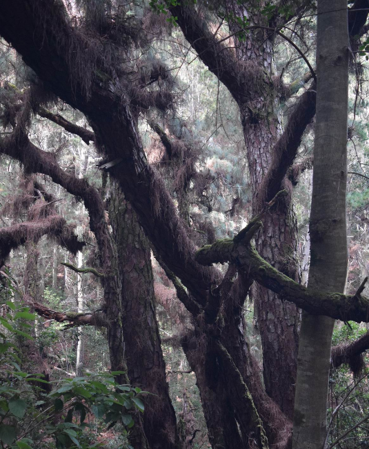
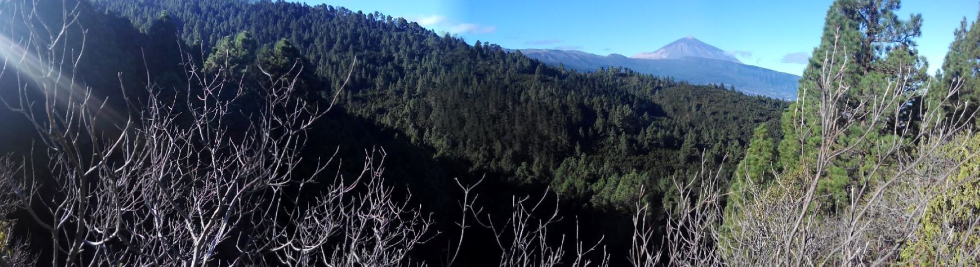
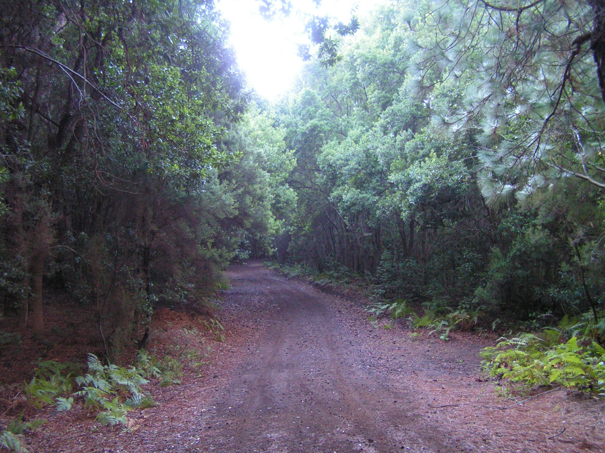
This route takes you through dense woodland typical of the northern uplands of Tenerife.

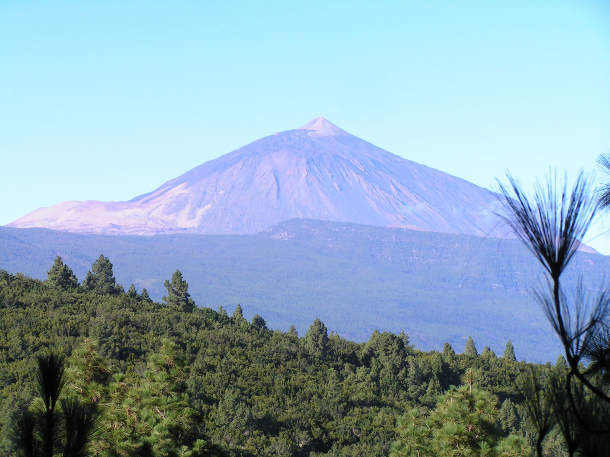
And the occasional gaps that open up in the canopy of pine trees along the route provide spectacular views of Mt Teide to the west.

Tips

  • Always stay on the marked trail observing all traffic rules established in the regulations. 
  • When parking, keep away from water intakes or firefighting water storage tanks, and do not block the passage of other vehicles or access to the track.
  • Be extra careful both at junctions with paths and tracks and on sections shared by walkers, horse riders and cyclists. 
  • Proceed with care to avoid accidents that may be caused by obstacles, landslides and uneven terrain. 
  • Check our guide to motor vehicle routes and, if necessary, contact the emergency services by calling 112.
Recommendations and tips

Guides

No data available

Permits

Prior authorisation through the Reservation Centre of the Tenerife Island Council is compulsory for the following vehicles:

  • Trials, enduro and motocross bikes.
  • ATVs and quads with a handlebar steering system.
  • Off-road vehicles with tyres of 10 to 15mm tread depth.
  • Power-assisted pedal cycles with a power output of more than 0.5 kW, to supplement the muscle power of the rider.
  • Caravan of up to six motor vehicles in motion with a maximum distance of 30 metres separating them.

Check the Regulations for information on prohibited vehicles.

No reservations are required for other vehicles, provided that they meet the recreational use requirements for this network of trails.

More information

Technical information sheet

Route information

Motor vehicle route

Tenerife ON

Linear

2,61 km

0 h 15 m

191,52 m

12,46 m

At an average speed of 15 km/h

  • Altitude gain:191,52 m

  • Altitude loss:12,46 m

  • Maximum altitude:1.221,55 m

  • Minimum altitude:1.042,02 m

Signage

Route code

VM-5.1

Tracks for motor vehicles are marked with blue signs and posts that include:

  • Direction.
  • Route number.
  • Distance to end point.
Signage

Route map and profile

Elevation profile

  • Maximum altitude:1.221,55 m

  • Minimum altitude:1.042,02 m

Connections with other routes

Municipalities passed through

  • Santa Úrsula

Weather

Today, monday, in Santa Úrsula


Clouds
Wind

6 km/h

Temperature

18ºC Maximum

14ºC Minimum

Rain

0%

3 day forecast

tuesday

19ºC Maximum

15ºC Minimum

wednesday

20ºC Maximum

16ºC Minimum

thursday

20ºC Maximum

16ºC Minimum

Places of interest

These are some of the points of interest you can find along this route.

Pino_Rey
Monumental tree

Pino Rey

With acebiño (Ilex canariensis) and tree heath (Erica arborea) growing at its...

Monumental tree

“Don Alberto” Pine Tree

Not easily measurable, its perimeter is approximately 7 m. It branches out at a height of 2.50m....