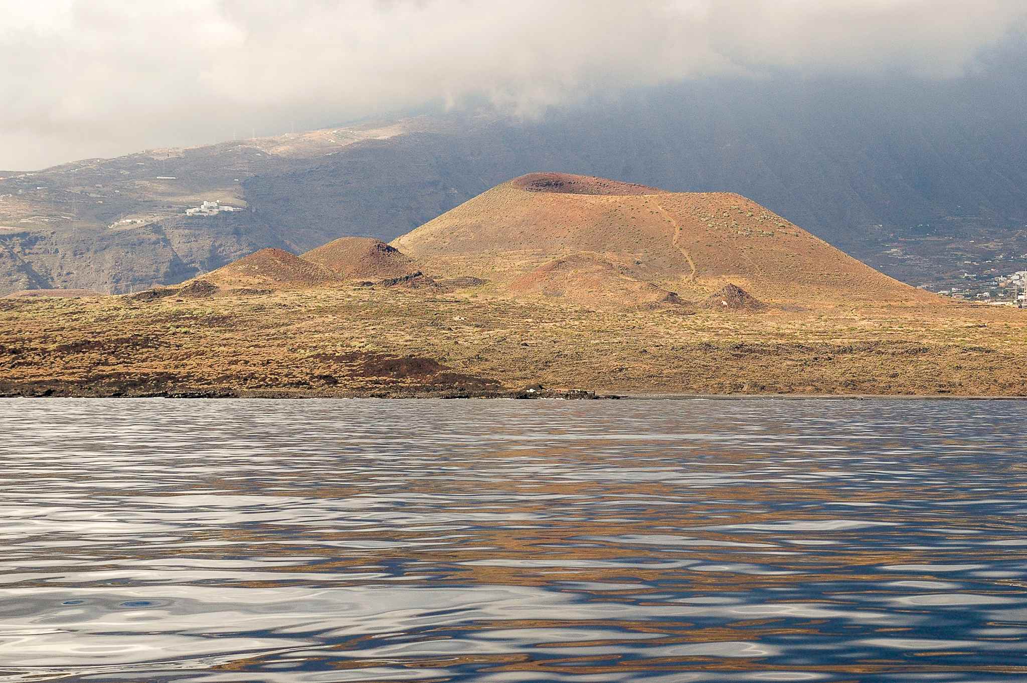
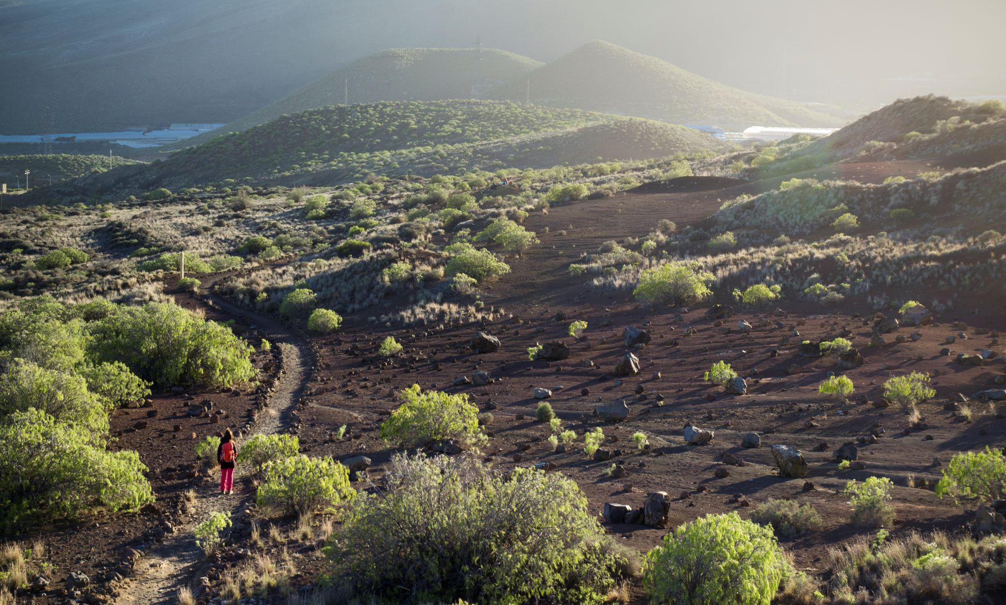
ePrivacy and GPDR Cookie Consent management by TermsFeed Privacy Policy and Consent Generator SL TF 900.1 Montaña Grande – Camino del Socorro Spur Trail

SL TF 900.1 Montaña Grande – Camino del Socorro Spur Trail

SL TF 900.1

Malpaís de Güímar

Difficulty: Very low

Description

Short hike of less than 500 meters that connects SL TF 903 El Socorro – Montaña Grande (in its protected section designated as a Cultural Heritage Site – BIC, "Camino del Socorro") with SL TF 900 Montaña Grande Loop Trail, at its northeastern end. It is a useful access point for combining routes in the Malpaís de Güímar.

Tips

  • Always stay on the marked trail and do not enter private property, hunting grounds, water galleries, wells or caves.  
  • Pay special attention when crossing or walking along trails used by bicycles, horses or motor vehicles and when walking in ravines with water courses.
  • Avoid direct encounters with potentially dangerous animals, such as livestock, beehives, and dogs.
  • Proceed with caution and watch for obstacles, loose rocks, uneven terrain or steep slopes to avoid accidents and falls.
  • Check out our guide to hiking in Tenerife and, if necessary, contact the emergency services by calling 112.
Recommendations and tips

Guides

No data available

Permits

  • [TEMPORARY MEASURE] Free access without authorisation or reservation for natural or legal entities of a public or private nature, both non-profit (town councils, schools, associations, clubs, etc.) and for-profit (active tourism companies), until 31 December 2024 as established in the Resolution.
  • Free access for all other visitors, no reservation required.
  • Email for enquiries - This email address is being protected from spambots. You need JavaScript enabled to view it.
More information

Technical information sheet

Route information

Walking route

Check your fitness level

Tenerife ON

Linear

0,47 km

0 h 15 m *

  • Altitude gain:2,76 m

  • Altitude loss:15,10 m

  • Maximum altitude:82,10 m

  • Minimum altitude:68,61 m

Signage

Route code

SL TF 900.1

Wooden and metal signs with the logo of the Cabildo and the Malpaís de Güímar Special Nature Reserve with a range of information.

Signage

Route map and profile

Elevation profile

Difficulty

Very low *MIDE safe mountain criteria

  • Maximum altitude:82,10 m

  • Minimum altitude:68,61 m

Connections with other routes

How to get to route start point

SL TF 903 El Socorro – Montaña Grande (protected section as BIC: Camino del Socorro).

No nearby service.

Only accessible on foot.

How to get to route end point

SL TF 900 Circular Montaña Grande, at the northeasternmost point.

No nearby service.

Only accessible on foot.

Municipalities passed through

  • Güímar

Protected Areas

Transit

Reserva Natural Especial del Malpaís de Güímar

The Malpaís de Güímar is one of the most popular spots in the south of Tenerife. Its volcanic cone stands out along the motorway linking the capital with the south of the island, and at its ...

Discover the Protected Area
Reserva Natural Especial del Malpaís de Güímar

Weather

Today, saturday, in Güímar


Clouds
Wind

17 km/h

Temperature

20ºC Maximum

18ºC Minimum

Rain

0%

3 day forecast

sunday

23ºC Maximum

18ºC Minimum

monday

23ºC Maximum

18ºC Minimum

tuesday

23ºC Maximum

19ºC Minimum