ePrivacy and GPDR Cookie Consent management by TermsFeed Privacy Policy and Consent Generator Camino Viejo Candelaria (section Llano del Moro - Igueste de Candelaria)

Camino Viejo Candelaria (section Llano del Moro - Igueste de Candelaria)

Barranco Hondo - Igueste de Candelaria

Incident Incident

Route temporarily closed - Works

Tramo en obras, transite con precaución - Section under construction, proceed with caution - Abschnitt in Bauarbeiten, bitte vorsichtig passieren.

Difficulty: Medium

Description

This trail is part of the pilgrimage route associated with Our Lady of Candelaria, a way steeped in tradition, culture and spirituality that has connected San Cristóbal de La Laguna with the Marian shrine in Candelaria since the 16th century.

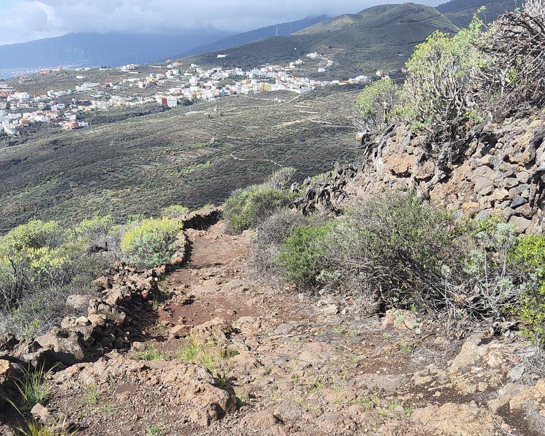
This section of the route begins in Plaza de Gabriel Cruz in Llano del Moro, in the municipality of El Rosario, and heads southeast along Camino del Convento.

Along the way, the trail crosses through Machado and reaches the Church of San José in Barranco Hondo. From there, it continues towards the ravine named Barranco de Siete Fuentes until it reaches the Igueste Viewpoint, where it descends to the end point of the route in Igueste de Candelaria.

This stretch of the trail takes you through a landscape brimming with history, with spectacular views of the Güímar Valley and, on clear days, much of the south of the island. It is the perfect route if you are looking to combine nature, tradition and heritage in a single experience.

Tips

  • Always stay on the marked trail and do not enter private property, hunting grounds, water galleries, wells or caves.
  • Pay special attention when crossing or walking along trails used by bicycles, horses or motor vehicles and when walking in ravines with water courses.
  • Avoid direct encounters with potentially dangerous animals, such as livestock, beehives, and dogs. 
  • Proceed with caution and watch for obstacles, loose rocks, uneven terrain or steep slopes to avoid accidents and falls.
  • Check out our guide to hiking in Tenerife and, if necessary, contact the emergency services by calling 112.
Recommendations and tips

Guides

No data available

Permits

  • [TEMPORARY MEASURE] Free access without authorisation or reservation for natural or legal entities of a public or private nature, both non-profit (town councils, schools, associations, clubs, etc.) and for-profit (active tourism companies), until 31 December 2026 as established in the Resolution.
  • Free access for all other visitors, no reservation required.
  • Email for enquiries - This email address is being protected from spambots. You need JavaScript enabled to view it.
More information

Technical information sheet

Route information

Walking route

Check your fitness level

Tenerife ON

Linear

10,44 km

3 h 45 m *

  • Altitude gain:405,22 m

  • Altitude loss:719,12 m

  • Maximum altitude:627,96 m

  • Minimum altitude:272,13 m

Signage

White panels with the symbol of Camino de Candelaria and information on directions, connections and distances.

Signage

Route map and profile

Elevation profile

Difficulty

Medium *MIDE safe mountain criteria

  • Maximum altitude:627,96 m

  • Minimum altitude:272,13 m

Connections with other routes

How to get to route start point

Plaza de Gabriel Cruz, road from La Esperanza to Llano del Moro (TF-272) where it meets Camino del Convento, Llano del Moro, El Rosario.

Bus number 260 and 939, Llano del Moro bus stop code 1841. TITSA

Very limited parking spaces in the town.

How to get to route end point

Parroquia de la Santísima Trinidad, Plaza de la Trinidad, Igueste de Candelaria.

No public transport in the area.

Parking spaces available in urban area.

Municipalities passed through

  • Candelaria
  • El Rosario
  • Santa Cruz de Tenerife

Weather

Today, monday, in El Rosario


Clouds
Wind

19 km/h

Temperature

22ºC Maximum

19ºC Minimum

Rain

0%

3 day forecast

tuesday

19ºC Maximum

17ºC Minimum

wednesday

19ºC Maximum

16ºC Minimum

thursday

18ºC Maximum

16ºC Minimum